Radefeld, Hauptmann von
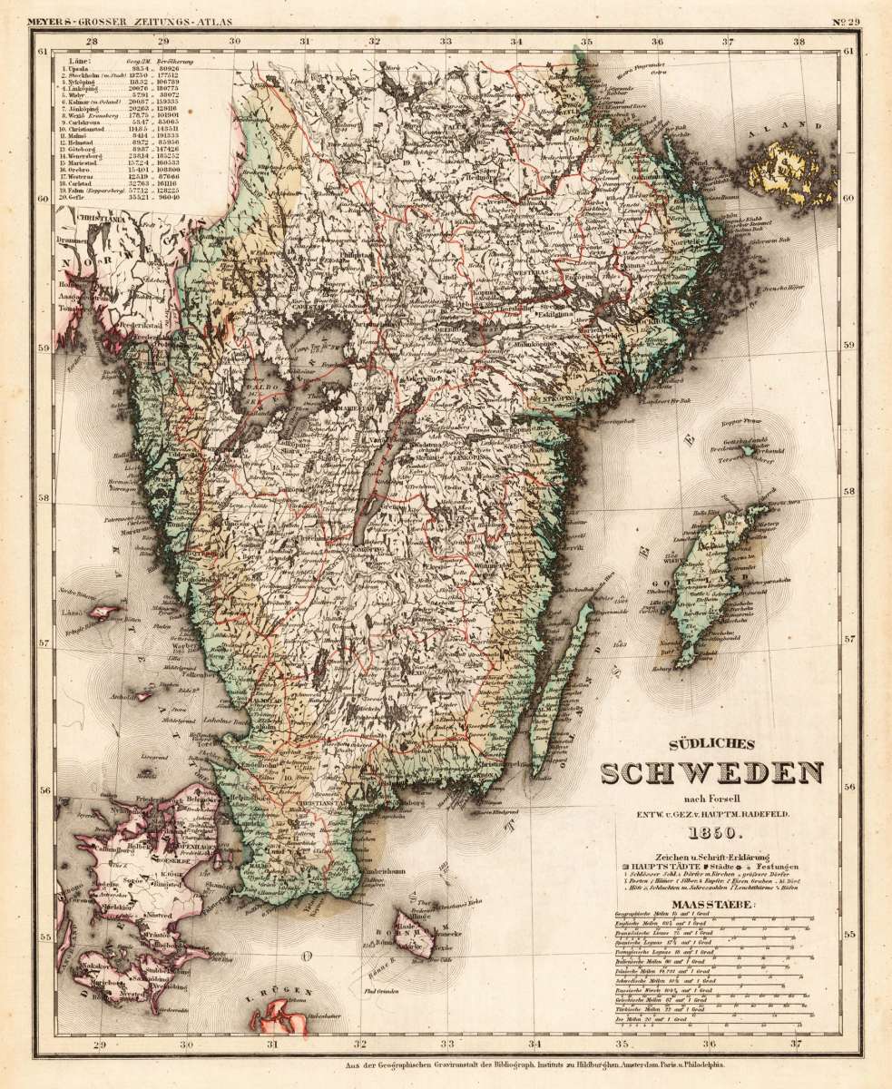
Südliches Schweden nach Forsell Ent. u. Gez. v. Hauptm. Radefeld. 1850
Prices incl. VAT plus shipping costs
This item is sold. Please contact us if you are searching for this item.
- Published: Meyers. , Hildburghausen
- Published date: 1850
- Type: Antique Map, map
- Technique: Steel engraving, original color
- Category: Southern Sweden
- Issue date: 1850
- Size: 372 by 302mm (14¾ by 12 inches).
- Stock number: 25632
- Condition: In excellent condition.
Article description
A excellent example of this map by Capt. Radefeld, published in 'Meyer's Handatlas', colored in outline when published. Detailed map of Southern Sweden, providing many information on settlements, villages and cities, rivers, lakes etc. Ornated in the upper left corner with a listing of Swedish cities and the populations, near the engraved title we find mileage scales.
Meyer's Handatlas is the name of various atlases published by the Bibliographical Institute, founded in 1826 by Carl Joseph Meyer.
From 1830 Meyer published maps and map series in his own "Artistic-Geographic Institution". These sheets were combined in different combinations to form different atlases. For example, the school atlas developed into a “New Large School Atlas”, later to “Meyer’s Universal Atlas” and “Meyer’s Newspaper Atlas for War and Peace”. Own maps were also added to Meyer's lexicon.
From 1843 Meyer produced a handheld atlas as a real in-house production, which could also withstand scientific requirements. The “Great Hand Atlas covering all parts of the world” appeared as a collective atlas in 171 deliveries and was not completed until 1860. Only a few copies of the atlas in this original form have survived. Meyer's atlas exceeded the atlases of the Geographical Institute Weimar and von Stieler by more than double.
The map sheets were executed in steel engraving and largely designed by Major Radefeld. New was the inclusion of maps with height information, maps with city maps and the inclusion of thematic maps. Another special feature was the greater weight on maps of the New World. The atlas also contained large maps that were spread over several individual sheets. Individual maps of the atlas were partly put together again for new publications, for example for “Meyer's emigration atlas in 48 maps of the western hemisphere”.
From 1862 the publishing house published a less extensive atlas, which was also called "Ravenstein's Handatlas" after the head of the cartographic institute Ludwig Ravenstein. A total of seven editions of this atlas had appeared by 1877.
In the following, Meyer produced map volumes in lexicon format as additional volumes for his conversation encyclopedias, and from 1892 also as independent volumes, which were now published under the title “Meyer‘s kleine Handatlas”. From the second edition of this volume from 1899 to 1900, this atlas was then only called "Meyer‘s Handatlas" in lexicon format. Twelve editions of this were published by 1936. In addition, some special editions and abridged editions appeared. Meyer's Neuer Geographischer Handatlas (1966) and Großes Duden-Lexikon Weltatlas (1969) followed in the 20th century.
(Wikipedia)
You might also be interested in the following products
 Fionia
  Südliches...
  De Custen van...
  Südliches...