Meyer, Joseph
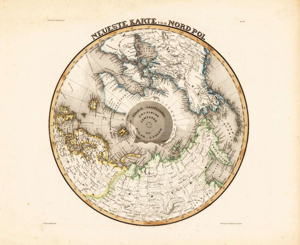
Neueste Karte vom Nordpol
€180.00
Prices incl. VAT plus shipping costs
This item is sold. Please contact us if you are searching for this item.
Eigenschaften
- Published: Bibliograph. Institut , Hildburghausen
- Published date: 1845
- Type: Antique Map, map
- Technique: Steel engraving, original color
- Issue date: 1845-50
- Category: North Pole
- Size: 310 by 310mm (12¼ by 12¼ inches).
- Stock number: 19780
- Condition: In excellent condition.
Article description
Article description
Steel engraving hand colored in outline when published, Interesting map showing the North Pole with parts of Canada, North America, Europe and Asia. The map shows engraved place names, rivers as well engraved border lines of the 'Frozen Sea' and the 'Floating Ice' are engraved.You might also be interested in the following products
 Illustrationen zu...
 Original antique lithograph, printed in colours, published by Justus Perthes in Gotha for 'Petermanns...
€40.00
 Wie wir einen...
 Original antique lithograph, uncoloured, published by C. Hellfarth in Gotha for 'Petermanns Geographische...
€35.00
 Northern Regions.
 Steel engraving, uncolored as published. A very nice map from Northern Regions. With many place names, rivers,...
€70.00
Recently viewed products