Products from Bonne, Rigobert
No results were found for the filter!
 Le Nord de L'Europe. Contentant le Danemark, la Norwege, la Suede et la Laponie; avec la Majeure Partie de la...
 Copper engraving, uncolored as published. Rigobert Bonne (1727-1794) was a French cartographer of the late 18th century. He studied in Paris and practiced...
€75.00
 Terre de Kerguelen, Apellee par M. Cook, Isle de la Desolation. Par M. Bonne, Ingenieur-Hydrographe de la Marine.
 Copper engraving, uncolored as published. Rigobert Bonne (1727-1794) was a French cartographer of the late 18th century. He studied in Paris and practiced...
€95.00
 Carte de la Rivière de Cook dans la partie N. O. De L`Amerique. Par M. Bonne, Ingènieur-Hydrographe de la Marine.
 Copper engraving, uncolored as published. Rigobert Bonne (1727-1794) was a French cartographer of the late 18th century. He studied in Paris and practiced...
€95.00
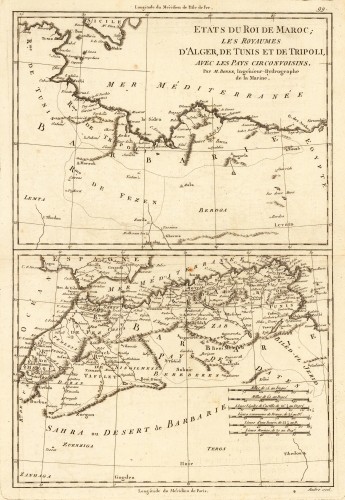
 Etats du Roi de Maroc; les Royaumes D' Alger, De Tunis et de Tripoli, avec les Pays Circonvoisins.
 Original antique copper engraving, uncolored as published. Two interesting maps of North Africa on 1 double page sheet. Published 1780 in Paris at...
€80.00
 (Coast of West Africa)
 Copper engraving, hand colored in outline when published. This decorative map shows the central Westcoast of Africa with Guinea and the Kongo. The map is...
€75.00
 L'Ancien et Le Nouveau Méxique, avec la Floride et la Basse Louisiane. Partie Orientale.
 Original antique copper engraving, uncolored. This antique map shows the Gulf of Mexico with many place names, rivers, mountain, lakes, etc. In the lower...
€195.00
 Turquie D' Europe. Par M. Bonne, Ingenieur-Hydrographe de la Marine.
 Engraved decorative map of southeast Europe showing Greece in the center of the map. A milage scale in the lower right corner. This decorative map shows the...
€95.00
 Isles de la Reine Charlotte. Par Bonne, Ingénieur-Hydrographe de la Marine.
 Original antique copper engraving, uncolored as published. This interesting map is based on Cook's voyages, and shows parts of the Solomon Islands...
€95.00
 Isles des Nouvelles Hébrides, et celle de la Nouvelle Calédonie. Par M. Bonne, Ingénieur-Hydrographe de la Marine.
 Original antique copper engraving, uncolored as published. This decorative map of New Caledonia and Vanuatu shows track of Cook's second voyage....
€95.00
 Carte des Découvertes du Capite. Carteret dans la Nlle. Bretagne, avec une partie du passage du Capite. Cook par le...
 Original antique copper engraving, uncolored as published. Interesting antique map of Papua New Guinea and the regions to the West, Southern Mindanao, Joseph...
€95.00
 Carte des Isles Amis. Par M. Bonne, Ingr.-Hydrographe. de la Marine. 1760
 Original antique copper engraving, uncolored as published. Thist detailed plan shows du Havre de Tongataboo, Tabouai Island, Mangeea Island, Wateeoo Island,...
€75.00
 L Empire de Russie, en Europe et en Asie. Iere. Feuille. Par M. Bonne. Ingenr. Hydrogrape. de la Marine.
 Original antique copper engraving, hand colored in outline and wash. Decorative map of Russia and Europe in Asia. Rigobert Bonne (6 October 1727 – 2...
€65.00
Recently viewed products

