Bonne, Rigobert
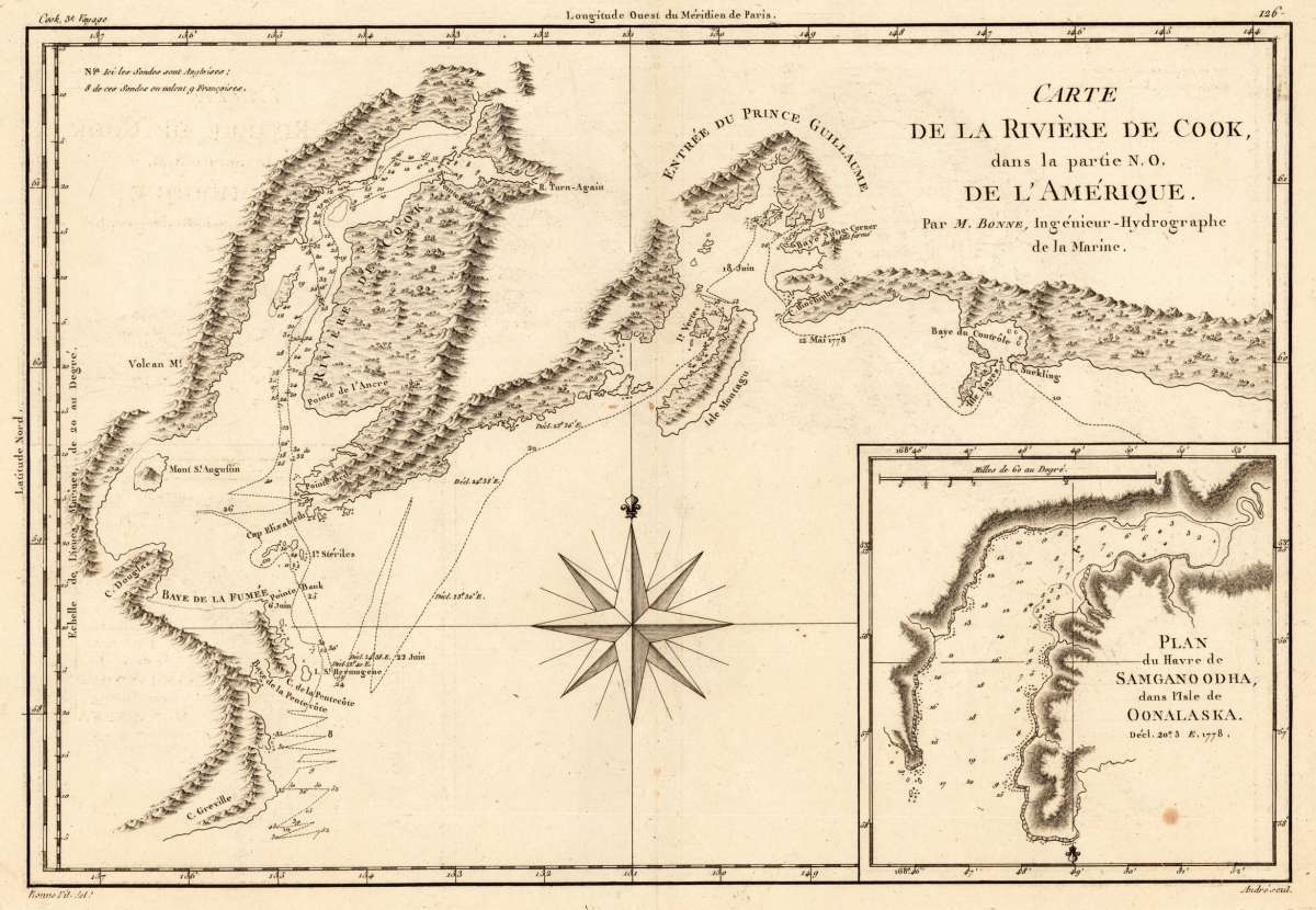
Carte de la Rivière de Cook dans la partie N. O. De L`Amerique. Par M. Bonne, Ingènieur-Hydrographe de la Marine.
Bonne, Rigobert – Carte de la Rivière de Cook dans la partie N. O. De L`A... · Antique Map, Copper Engraving · 234 x 345mm · M. Bonne, Paris 1780
Eigenschaften
- Published: M. Bonne , Paris
- Published date: 1780
- Type: Antique Map, map
- Technique: Copper engraving / Uncolored
- Issue date: 1780
- Category: Alaska
- Size: 234 by 345mm (9 by 13 inches).
- Stock number: 25775
- Condition: In excellent condition.
Article description
Article description
Copper Engraving, uncolored by Bonne, Rigobert, published 1780 by M. Bonne, Paris. Image size: 234 by 345mm (9 by 13 inches). By France's Royal Cartographer — a fine example of late Enlightenment scientific cartography. Rigobert Bonne (1727–1794) was one of the most important French cartographers of the late 18th century. In 1773 he succeeded the legendary Jacques-Nicolas Bellin as Royal Cartographer to France, serving as First Hydrographer of the Dépôt de Cartes et Plans de la Marine from 1775 to 1789. He drew the maps for the Abbé Raynal's Atlas de toutes les parties connues du globe terrestre (1780) and is best known for his work on the Atlas encyclopédique (1788) with Nicolas Desmarest. Bonne's cartographic style represents the transition from the decorative 17th-century tradition toward a more scientific, detail-oriented aesthetic. His maps, notable for their precision and clear hydrographic delineation, were widely reprinted throughout Europe and remain sought after by collectors of Enlightenment-era cartography. Rigobert Bonne (1727-1794) was a French cartographer of the late 18th century. He studied in Paris and practiced cartography. He became a skilled cartographer and hydrographer and became a royal hydrographer at the,Depot de la Marine' in 1773. In 1780 he engraved and published the maps for Abbe Raynal's work,Atlas de Toutes Les Parties Connues du Globe Terrestre'. He also published many charts for the,Depot de la Marine', further he engraved the maps for the,Atlas Encyclopedique' in 1788 together with Nicholas Desmarest. In excellent condition.Bonne, Rigobert – Carte de la Rivière de Cook dans la partie N. O. De L`A... · Antique Map, Copper Engraving · 234 x 345mm · M. Bonne, Paris 1780
Recently viewed products