Cellarius, Andreas
Atlas Coelestis, seu Harmonia Macrocosmica. Apud G. Valk et P. Schenk.
Harmonia Macrocosmica seu atlas Universalis et Novus, Totius Universi Creati Cosmographiam Generalem, et Novam Exhibens. In qua Omnium totius Mundi Orbium Harmonica Constructio, secundum diversas...Studio et Labore Andreae Cellarii Palatini, Scholz Hornanz in Hollandia Boreali Rectoris.
- Published: Amsterdam
- Published date: 1708
- Issue date: 1708
- Type: Book
- Technique: Book
- Size: 51 x 34 cm (20 x 13.5 inches).
- Stock number: 30466
- Condition: Contemporary vellum binding of the period, covers richly gilt decorated. The spine carefully renewed. The printed title-page and index page with minor spotting, the engraved title-page with small tracks of use, one double page engraved map with a minor repair verso, some plates with small marginal spots, else a nice old colored example in very good to excellent condition. Provenance: collection Lord Wardington (book plate).
Article description
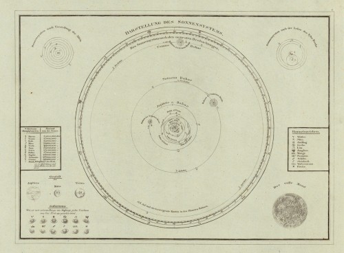
Large Folio. Printed title, engraved old colored title page, table of contents with index of the maps, illustrated with 29 fine old colored engraved celestial maps, the outer borders and some cartouches maybe at a later date colored. Vellum bindung of the period, covers richly gilt and decorated, spine renewed. The ‚Harmonia Macrocosmica...' by Andreas Cellarius is the most famous and spectacular celestial atlas published in the 17th century. It appeared in three editions: 1660, 1661 and 1708. The 1st edition 1660 was published as a supplement to the famous 'Atlas Novus...' by Joannes Janssonius in Amsterdam. At a later date the copper plates were acquired with by Gerard Valk and Petrus Schenk, map and booksellers in Amsterdam when they took over the inventory of the publishing house of Joannes Jannsonius. They reissued this famous celestial atlas 1708 in their printing house in Amsterdam. The copper plates were used unaltered apart from the addition of the imprint: 'Prostant Amstelaedami apud Petrum Schenk, et Gerardum Valk. C.P.' The Cellarius celestial atlas sold very well among their wide range of cartographic products of atlases, globes and wall maps. It was either sold individually or as a supplement to some of their famous world atlases. It contained only an allegoric title-page engraved by F. H. v. Hoven, a typographic title-page printed in black and red, one printed index table and the 29 double engraved celestial maps. In his sky atlas, Andreas Cellarius shows the often contradictory theories that prevailed at the time. In addition to Tycho Brahe and Schiller's celestial models, Andreas Cellarius also presents maps reflecting the theories of Ptolemy and also includes Copernicus as a 16th-century challenge to commemorate the venerable ancient astronomer. Cellarius' celestial atlas was also not without political motives. At that time, during his tenure, the Netherlands had been the undisputed center of scientific discovery. The Dutch cartographers had stood above all others. It is also assumed that Louis XV. tried to bring France to the forefront of science and thus catch up with political dominance. His efforts led to a major competition between France and the Netherlands. Andreas Cellarius also tried to thwart the French attempts with his extremely complex sky atlas. In some maps, Cellarius incorporated French elements into his celestial maps, such as acanthus leaves commonly seen on French furniture of the period. In this way he used decorative French pictorial elements more skilfully than they could themselves.
Harmonia Macrocosmica seu atlas Universalis et Novus, Totius Universi Creati Cosmographiam Generalem, et Novam Exhibens. In qua Omnium totius Mundi Orbium Harmonica Constructio, secundum diversas...Studio et Labore Andreae Cellarii Palatini, Scholz Hornanz in Hollandia Boreali Rectoris.


