Flemming, Carl
Mexico
€124.00
Prices incl. VAT plus shipping costs
This item is sold. Please contact us if you are searching for this item.
Eigenschaften
- Published: Flemming , Glogau
- Published date: 1881
- Type: Antique Map, map
- Technique: Lithograph / Original color.
- Issue date: 1881
- Category: Mexico
- Size: 330 by 405mm (13 by 16 inches).
- Stock number: 14208
- Condition: In excellent condition. 330 by 405mm (13 by 16 inches).
Article description
Article description
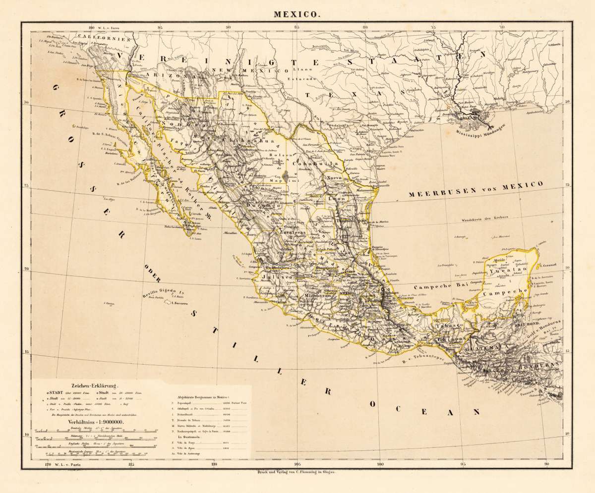
Lithograph, original hand color in outline. Decorative territorial map showing the Southwest of the United States with Mexico, Baja California and the neighboring states Arizona, New Mexico and Texas. The map extends in the South towards Yucatan, Guatemala and Honduras. A interesting map by the famous German cartographer and publisher Carl Flemming from Glogau published in his edition of 1881.You might also be interested in the following products
 Amér. Sep. Partie...
 Lithograph, hand-colored in outline by Vandermaelen, Phillippe Marie, published 1825 by Brussels. Image size: 470 by...
€142.00
 Hispaniae Novae...
 Copper Engraving, uncolored by Mercator, Gerard, published 1632 by I.E. Cloppenburgh, Amsterdam. Image size: 190 by...
€240.00
 Amèr. Sep. Partie...
 Lithograph, hand-colored in outline by Vandermaelen, Phillippe Marie, published 1827 by Brussels. Image size: 470 by...
€695.00
 Amèr. Sep. Partie...
 Lithograph, hand-colored in outline by Vandermaelen, Phillippe Marie, published 1827 by Brussels. Image size: 458 by...
€400.00
Recently viewed products