The following products have been found matching your search "Europe karte": 72
Or did you mean: europe | karten | karte | EUROPA | ortelius europe | old europe | carte | eastern europe
No results were found for the filter!
 Carte D' Europe.
 Copper engraving, hand colored in outline when published. This small antique map shows Europe with his countries....
€110.00
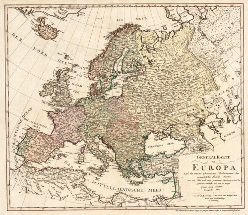
 Generalkarte von Europa, nach den neuesten astronomischen Beobachtungen, den vorzüglichsten Special-Karten und zu...
 Original antique copper engraving, hand colored in outline and wash when published. An interesting and detailed map...
€445.00
 General Karte von dem Koenigreiche Ungarn und dem Osmanischen Reiche in Europa. Nro. 1.
 Original copper engraving, hand colored in wash and outline, when published. This antique map shows the kingdom of...
€125.00
 General=Karte von Grossbritannien und Ireland Nro. 78,
 Original copper engraving, hand colored in wash and outline, when published. The Austrian cartographer Franz...
€275.00
 Spezial Karte von dem Königreiche England. Nro. 79.
 Original copper engraving, hand colored in wash and outline, when published. The Austrian cartographer Franz...
€195.00
 Karte von dem K. Württ. Oberamt Horb.
 Original Lithographie gedruckt in Farben. Die detaillierte Karte des Königl. Württembergischem Oberamt Horb um...
€60.00
 Karte von dem Königl. Württ. Oberamt Rottweil.
 Original Lithographie gedruckt in Farben. Die detaillierte Karte des Königl. Württembergischem Oberamt Rottweil um...
€60.00
 General Karte von dem Königreichen Schweden Daenemark u. Norwegen mit Grönland und den Inseln Istland und Foeröer....
 Original copper engraving, hand colored in wash and outline, when published. The Austrian cartographer Franz...
€225.00
 Karte von dem Koenigreiche Preussen nach Suchodolez und Endersch neu verzeichnet herausgegeben von Franz Joh. Jos....
 Original copper engraving, hand colored in wash and outline, when published. This large antique map by Franz Johann...
€245.00
 Karte der wichtigsten Habituellen Stossgebiete in Central-Europa. Nach Dr. Volger's Untersuchungen gez. von A....
 Lithograph, original color in outline as published.
€25.00
 Neueste Karte von Holland, Belgien und Luxemburg.
 Steel engraving, handcolored in outline, when published. Small and decorative map of the Low Countries, showing many...
€80.00
 General Karte Des Osmanischen Reichs.
 Steel engraving, hand colored in outline, when published. Decorative and interesting map showing the Osman Imperium,...
€75.00

