Schneider, Adam Gottlieb u. Weigel, Johann Christoph
Generalkarte von Europa, nach den neuesten astronomischen Beobachtungen, den vorzüglichsten Special-Karten und zu...
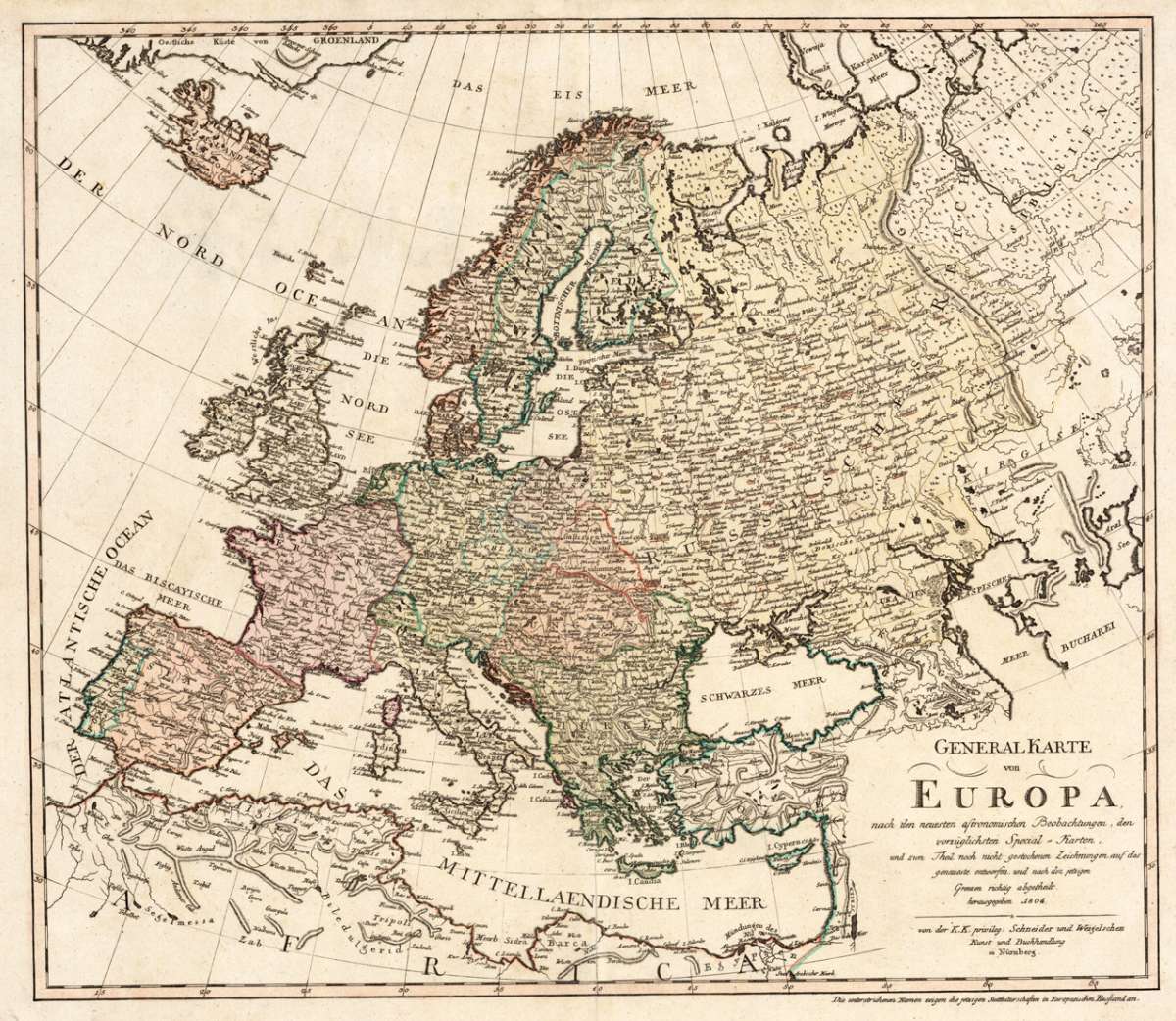
Generalkarte von Europa – A. G. Schneider & J. C. Weigel, Nürnberg 1804 · Original Hand-Colored Copper Engraving · Large Antique Map of Europe
Eigenschaften
- Published: Adam Gottlieb Schneider und Weigel , Nürnberg
- Published date: 1804
- Type: Antique Map, map
- Issue date: 1804
- Technique: Copper engraving / Original color
- Category: Europe with parts of Galizia, Prussia and Russia
- Size: 517 by 597mm (20 by 23 inches).
- Stock number: 29547
- Condition: In excellent condition. 517 by 597mm (20 by 23 inches).
Article description
Article description
Large and highly detailed antique map of Europe in original outline and wash color, published by Adam Gottlieb Schneider and Johann Christoph Weigel, Nuremberg, 1804. Image: 517 x 597 mm (20.25 x 23.5 inches). Political borders in color; underlined place names denoting Russian governorships. Extends north to Greenland and Iceland — an exceptional large-format early 19th-century German map. Johann Christoph Weigel (Christoph Weigel the Elder; 1654–1725) was a prominent German engraver, art dealer, and publisher based in Nuremberg, working in close association with the great Johann Baptist Homann. His maps were immediately hand-colored in outline and decorative wash upon printing, maintaining the high standard of the Nuremberg cartographic school. Adam Gottlieb Schneider (active 1794–1805) continued this tradition, following the lineage of Homann, Seutter, and Lotter, maintaining the Nuremberg school's reputation into the early 19th century. This large and impressive map of Europe was published in 1804 — just as Napoleon was reshaping the continent — and captures the political geography in remarkable detail. The underlined place names denote Russian governorships, a distinctive feature reflecting the administrative geography of the Russian Empire. The map extends from the British Isles and Iberian Peninsula east through Russia, with mountains, rivers, and hundreds of engraved place names throughout. In the northwest, Greenland and Iceland are depicted. At 517 x 597 mm, this is a substantial large-format map in the finest Nuremberg tradition. In excellent condition. Strong, sharp impression. Colors fresh and well-preserved. No tears, creases, or foxing. 517 x 597 mm.Generalkarte von Europa – A. G. Schneider & J. C. Weigel, Nürnberg 1804 · Original Hand-Colored Copper Engraving · Large Antique Map of Europe
You might also be interested in the following products
 Carte D' Europe.
 Original copper engraving with hand-applied outline color, by engraver Blondeau, published by the celebrated French...
€110.00
 Europa
 Original copper engraving with hand-applied outline color, published by Tranquillo Mollo — Vienna's leading map...
€110.00
 Romania Imperii...
 Original copper engraving of the Eastern Roman Empire after the geographic text of Michel'Antoine Baudrand,...
€295.00
 Geographia...
 Rare and decorative large-format historical map of Europe showing the locations of Church Councils and Synods, in...
€322.43
Recently viewed products