The following products have been found matching your search "map of radefeld": 194
Or did you mean: maps | man | map | world map | world maps | MAPS OF THE WORLD | map asia | wall map
No results were found for the filter!
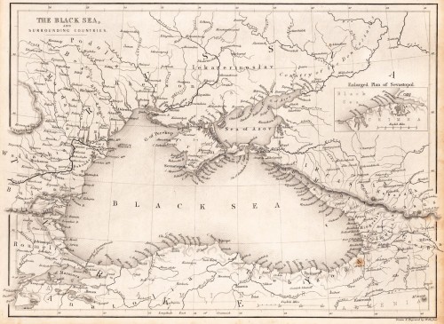
 The Black Sea, and surrounding countries.
 Steel engraving, uncolored as published. Detailed map of the Black Sea and its surrounding countries, published in...
€45.00
 Die Ehrenberger Clausen Ein Haupt Pass und Vestung im Tyrol gegen Schwaben mit Algow gelegen.
 Original antique copper engraving, uncolored as published. This fine copper engraving shows a view of the castle of...
€65.00
 Königreich Kroatien - nach der neuesten Begrenzung, und den vorzüglichsten Hülfsmitteln bearbeitet.. In Wien bey...
 Original antique copper engraving, hand colored in outline and wash, when published. An interesting map by the...
€195.00
 Petite Tartarie
 Copper engraving, hand colored in wash and outline, published in the German text edition of Allain Manesson...
€65.00
 Scandia, Sive Regiones Septentrionales
 Fine copper-engraved map, printed into the full text page, published in Geografia ... Universale de la Terra, which...
€375.00
 The Northern Provinces of Sweden and Norway with Part I. of Russia. - Published under the Superintendence of the...
 Steel engraving, hand colored in outline when published. A very decorative map from the northern provinces of Sweden...
€55.00
 Sweden and Norway
 Engraved map, handcolored in outline and wash. Decorative map of Sweden and Norway published 1856 at J.H. Colton in...
€60.00
 General Karte von dem Königreichen Schweden Daenemark u. Norwegen mit Grönland und den Inseln Istland und Foeröer....
 Original copper engraving, hand colored in wash and outline, when published. The Austrian cartographer Franz...
€225.00
 Provinz Posen
 Lithograph, original color in outline. Detailed map of the province of Posonia with Posen in its centre. The map...
€65.00
 Spitzberg und Neu Zemble - Spitzberg et N. Zemble.
 Copper engraving, hand colored in wash and outline. Attractive antique map of Spitzberg and the Polar region from...
€125.00
 Austriae Descrip. per Wolfgangum Lazium.
 Original antique copper engraving, published 1612 in a Italian Vrients edition of the " Theatrum Orbis Terrarum'....
€395.00
 Cajazzo - Calatia Vulgo Caiazo, perantiquum Campaniae Foeticis oppidum
 Original antique copper engraving, hand colored in outline and wash when published. Decorative city map of Caiazzo....
€240.00

