The following products have been found matching your search "ponuntur": 152
No results were found for the filter!
 Tienen. - Tiena
 Copper engraving, uncolored as published in the townbook "Civitates Orbis Terrarum" by Georg Braun and...
€300.00
 Neueste Karte von Arkansas mit seinen Canaelen Strassen & Entfernungen der Hauptpunkte.
 Steel engraving, hand colored in outline and wash when published. This antique map shows Arkansas with his canals,...
€70.00
 Moluccae Insulae Celeberrimae.
 Original antique copper engraving, hand colored in outline and wash when published. A highly decorative map of the...
€550.00
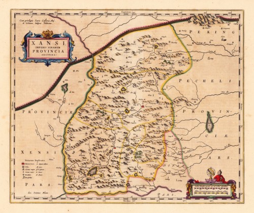
 Xansi. Imperii Sinarum Provincia Secunda.
 Original antique copper engraving, hand colored in outline published in Joan Blaeu's 'Atlas Novus'....
€600.00
 Insularum Archipelagi Septentrionalis seu Maris Aegaei Accurata Delinatio Auctore I. Laurenbergio.
 Original antique copper engraving, hand colored in outline when published. The map was published in Joan....
€495.00
 Walachia Servia, Bulgaria, Romania.
 Original antique copper engraving, hand colored in outline published in Joan Blaeu's 'Atlas Novus'....
€480.00
 Guiana sive Amazonum Regio
 Copper engraving, hand colored in outline and wash when published. French text edition. Decorative map extending...
€325.00
 Iaponia Regnum.
 Original antique copper engraving, hand colored in outline and wash when published. This detailed map of Japan was...
€1,250.00
 Insularum Moluccarum Nova Descritio
 Original antique copper engraving, hand colored in outline when published. Sea chart of the Molucca Islands, the...
€425.00
 Clivia Ducatus et Ravenstein Dominium.
 Engraved map in fine contemporary colors in outline and wash. Published in the edition of Blaeu's "Atlas...
€380.00
 De Custen van Engelant tusschen de twee pointen van Poortlandt en Lezard.
 Fascinating detailed seachart of the south-eastern coast of England showing the coastline from Lizard Point over...
€950.00
 Neueste Karte von Arkansas mit seinen Canaelen Strassen & Entfernungen der Hauptpunkte. Nach den bessten Quellen...
 Steel engraving, hand colored in outline and wash when published. This antique map shows Arkansas with his canals,...
€173.00

