Tardieu, P.A.F.
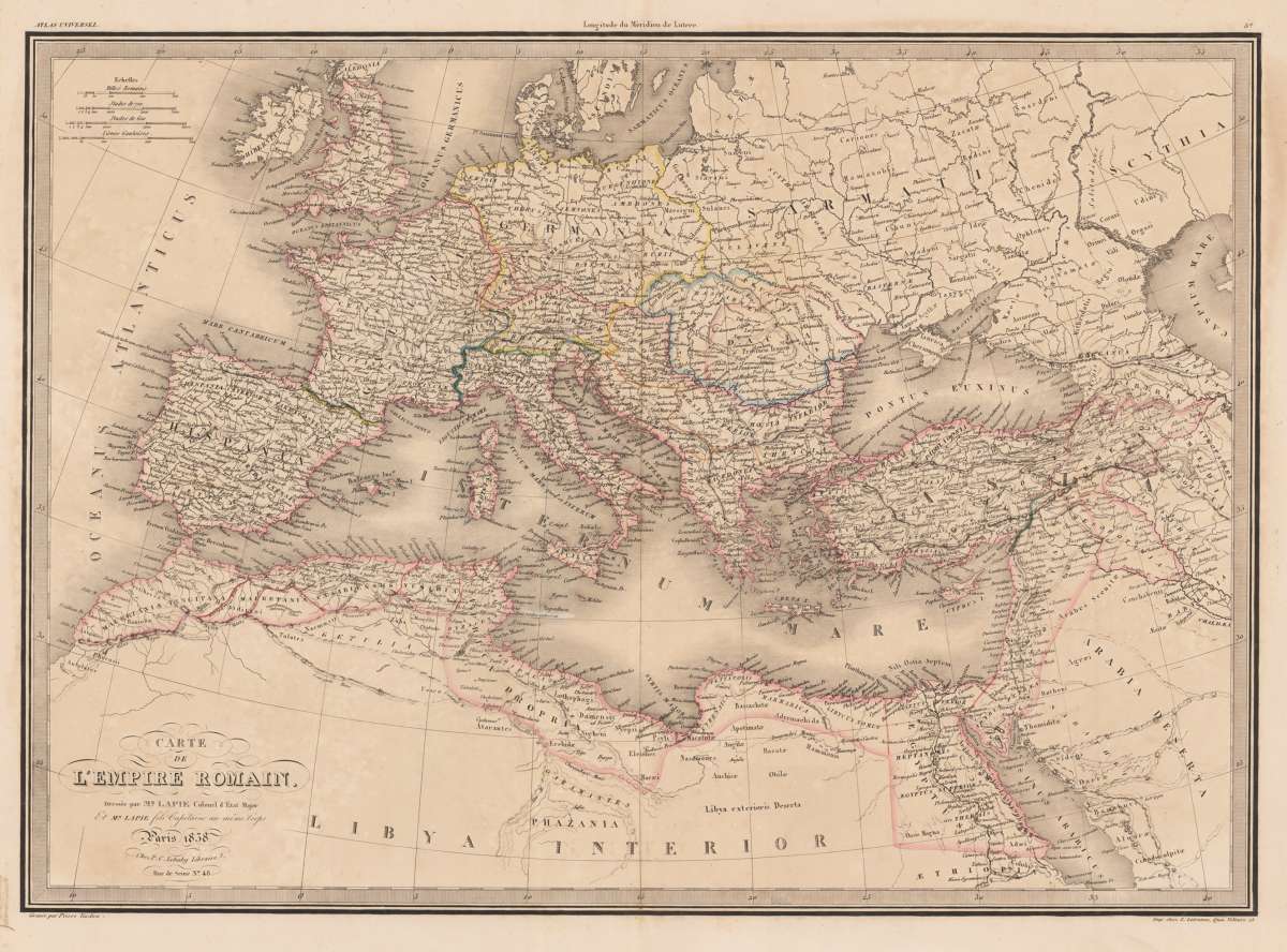
Carte de L´Empire Romain Dressée par Mr. Lapie Colonel d´Etat Major et Mr. Lapie... Paris 1838
Eigenschaften
- Published: Paris
- Published date: 1838
- Issue date: 1838
- Type: map
- Technique: Copper engraving / hand colored.
- Category: export origin NY Fair (RF Shipping)
- Size: 40 x 143 cm (15,75 x 56.25 inches).
- Stock number: 34597
- Condition: This large map was originally dissected in 24 parts and laid down on linen as a folded map. It has been taken off from the original linen and carefully joint together on its original linen to make up a complete map. Overall in very good to excellent condition. Hand colored in outline, when published. 1250 by 1430mm (49¼ by 56¼ inches).
Article description
Article description
Original antique copper engraving, hand colored in outline when published. This map shows the extent of the Roman empire at its height, and covers Britain, Germania, Gaul, Egypt, Africa proper, Spain, Italy and Macedonia. Finely hand colored in outline when published. Pierre François Tardieu (1711–1771) was a French engraver and cartographer, nephew of Nicolas-Henri Tardieu. Pierre Francois Tardieu was born around 1711 in Paris, son of Jean Tardieu. His uncle, Nicolas Henri Tardieu, taught him the art of engraving. He produced historical and genre works. He is noted for two excellent engravings after Peter Paul Rubens, the Judgement of Paris and Persée et Andromache. He did much work on the engravings for the Fables de la Fontaine after drawings by Oudry. Tardieu's second wife, Marie-Anne Rousselet (1733-1826), was from the family of the engraver Gilles Rousselet and the sculptor Jean Rousselet, both of whom were members of the Academy. (Wikipedia)You might also be interested in the following products
 Amerique...
 Copper engraving, hand colored in outline and wash when published. Fine engraved map of the state of North America...
€480.00
 America...
 Copper engraving, hand colored in wash when published. This map of North America published by G. Tasso in Venice is...
€475.00
 Bergsystem von...
 Original steel-engraving, hand colored in outline, when published. Detailed fine map of North-America s mountain...
€140.00
 Bergsystem von...
 Original steel-engraving, hand colored in outline, when published. Detailed fine map of North-America s mountain...
€145.00
Recently viewed products