van Keulen, Joan.
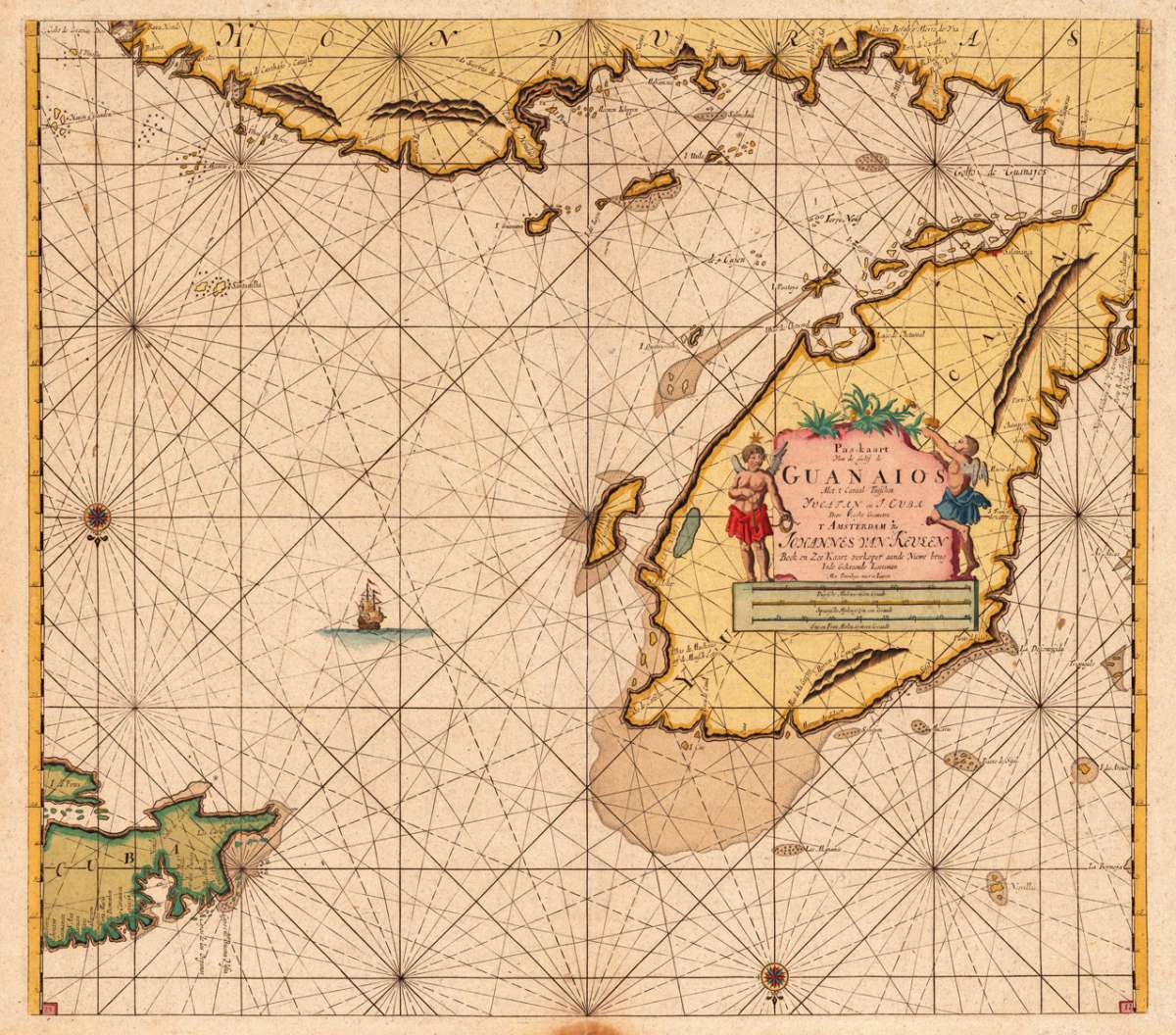
Pas-Kaart Van de Golff de Guanaios Met t Canaal Tusschen Yucatan en J. Cuba Door Vooght Geometra T Amsterdam By...
Eigenschaften
- Published: v. Keulen , Amsterdam
- Published date: 1684
- Type: Antique Map, map
- Technique: Copper engraving / later hand color
- Issue date: 1684-1700
- Size: 515 by 575mm (20 by 22 inches).
- Stock number: 24677
- Condition: 515 by 575mm (20 by 22 inches).
Article description
Article description
Original antique copper engraving, later hand colored. Johannes van Keulen (1654 in Deventer – 1715 in Amsterdam) was a 17th-century Dutch cartographer. He published the influential nautical atlas the Zee-Atlas and the pilot guide Zee-Fakkel (meaning Sea-Torch in English). In 1678 Johannes van Keulen established himself in Amsterdam and in 1680 he obtained a patent from the States of Holland and West Friesland allowing him to print and publish maritime atlases and shipping guides. These were books of maps and descriptions of itineraries, used by helmsmen for safe navigation. The patent was a kind of protection against illegal copying of produced books and charts. This was especially important for the atlases which were made with extensive initial costs. Van Keulen named his firm 'In de Gekroonde Lootsman' ('In the Crowned Pilot'). Soon Van Keulen struck a deal with cartographer Claes Jansz. Vooght. From 1681 onwards the Nieuwe Lichtende Zee-Fakkel appeared, a five-volume atlas for which Vooght compiled the maps[1] and which was illustrated by Jan Luyken. The five volume Zee-Fakkel made Johannes van Keulen famous. The Zee-Fakkel was published in 5 volumes between 1681 and 1684 containing over 130 new charts. (Wikipedia)You might also be interested in the following products
 Moluccae Insulae...
 Original antique copper engraving, hand colored in outline and wash when published. A highly decorative map of the...
€550.00
 Pascaert van...
 Original antique copper engraving, uncolored as published. Detailed chart of the Northeastern part of Canada,...
€1,750.00
 Pascaarte vande...
 Copper Engraving, uncolored by van Keulen, Joan, published 1684-1704 by Johannes van Keulen, Amsterdam. Image size:...
€1,100.00
 Pas kaart Van de...
 Original antique copper engraving, finely hand colored in outline and wash, probably later hand color. Detailed...
€750.00
Recently viewed products