Bellin, Nicolaus
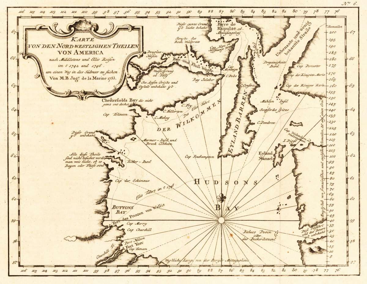
Karte von den Nord-Westlichen Theilen von America nach Middeltons und Ellis Reisen im J. 1742 und 1746 um einen Weg...
Bellin, Nicolaus – Karte von den Nord-Westlichen Theilen von America nach... · Antique Map, Copper Engraving · 205 x 267mm · Merkur, Leipzig 1753
Eigenschaften
- Published: Merkur , Leipzig
- Published date: 1753
- Type: Antique Map, map
- Technique: Copper engraving / Uncolored
- Issue date: 1753
- Category: Canada & Northwest America
- Size: 205 by 267mm (8 by 10 inches).
- Stock number: 14256
- Condition: In excellent condition. 205 by 267mm (8 by 10 inches).
Article description
Article description
Copper Engraving, uncolored by Bellin, Nicolaus, published 1753 by Merkur, Leipzig. Image size: 205 by 267mm (8 by 10 inches). By France's official Royal Hydrographer — among the most important cartographic records of 18th-century North America. Jacques-Nicolas Bellin (1703–1772) was one of the most important French cartographers of the 18th century. In 1721, at just 18 years of age, he was appointed Hydrographer to the French Navy, and in 1741 became the first Ingénieur de la Marine at the Dépôt des Cartes et Plans de la Marine — effectively France's official cartographer for 50 years. He prepared maps for major works including the Abbé Prévost's Histoire générale des voyages (1746–1759) and published the monumental Hydrographie française (1756–1765) containing 115 large coastal charts. Bellin was remarkable for his scholarly rigor: he always cited his sources and contributed over 1,400 articles on geography to Diderot's Encyclopédie. Today he is considered the most copied French cartographer of his century, and his maps are prized by collectors for their accuracy, elegant engraving, and historical importance. This very decorative antique map shows the Hudson Bay Area with its many islands. The title cartouche is in the upper left corner in German language engraved. In excellent condition.Bellin, Nicolaus – Karte von den Nord-Westlichen Theilen von America nach... · Antique Map, Copper Engraving · 205 x 267mm · Merkur, Leipzig 1753
You might also be interested in the following products
 Pascaarte vande...
 Copper Engraving, uncolored by van Keulen, Joan, published 1684-1704 by Johannes van Keulen, Amsterdam. Image size:...
€1,100.00
 Britisches Nord -...
 Lithograph, original color in outline by Flemming, Carl, published 1845 - 50 by C. Flemming, Glogau. Image size: 310...
€84.00
 Johnson's...
 Lithograph, original color in outline by Johnson & Ward, published 1865 by Johnson & Ward, New York. Image...
€45.00
 Le Canada Ou...
 Copper-engraving handcolored in outline, when published. Printed around 1693 by Hubert Jaillot in Paris, published in...
€1,400.00
Recently viewed products