SDUK (Society for the diffusion of useful knowledge)
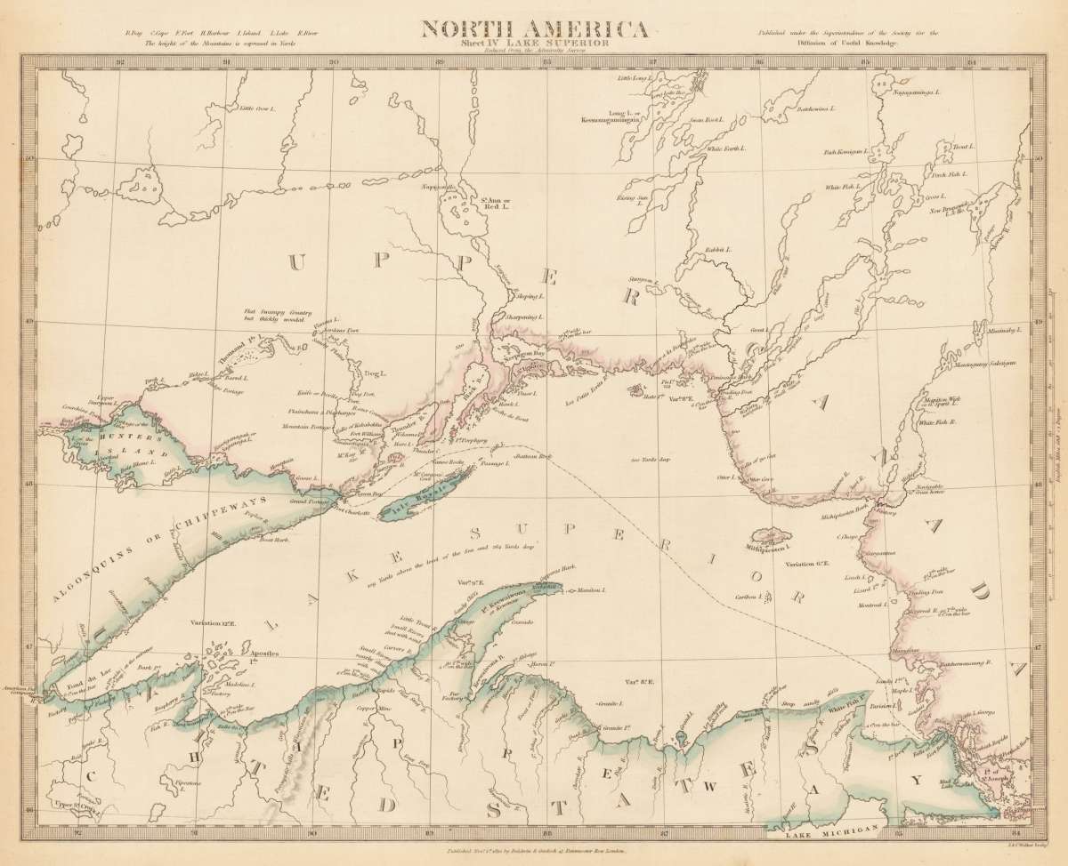
North America Sheet IV Lake Superior
Published under the Superintendence of the Society for the Diffusion of Usefull Knowledge.
€65.00
Prices incl. VAT plus shipping costs
This item is sold. Please contact us if you are searching for this item.
Eigenschaften
- Published: London
- Published date: 1832
- Technique: Steel engraving, original color
- Issue date: 1832
- Type: map
- Category: Lake Superior
- Size: 296 by 390mm (11 by 15 inches).
- Stock number: 21346
- Condition: In excellent condition. 296 by 390mm (11 by 15 inches).
Article description
Article description
Original antique steel engraving, hand colored in outline when published. This antique map shows the Lake Superior (the largest Lake in North America) and the surrounding. The Society for the Diffusion of Useful Knowledge (SDUK), founded in 1826 by Lord Brougham, was a Whiggish London organisation with the high-minded objective of bringing learning to the uneducated working and middle classes. Much of its output was regarded as unreadable, it was not commercially successful, and it was wound up in 1848. Its most enduring legacy is the wonderful set of atlas maps and sought-after town plans published under its auspices, which we stock below. Originally issued in parts by Baldwin & Cradock 1829-32, it was later published as an atlas by Chapman & Hall in 1844 and by Charles Knight between 1844-1852. It continued to be published after the demise of the Society by G. Cox 1852-1853 and Edward Stanford 1857-1870. The maps commonly have original outline colour. Fourteen members of the S.D.U.K. served on the Boundary Commission for the 1832 Great Reform Act. (Wikipedia)Published under the Superintendence of the Society for the Diffusion of Usefull Knowledge.
You might also be interested in the following products
 Pascaarte vande...
 Copper Engraving, uncolored by van Keulen, Joan, published 1684-1704 by Johannes van Keulen, Amsterdam. Image size:...
€1,100.00
 Britisches Nord -...
 Lithograph, original color in outline by Flemming, Carl, published 1845 - 50 by C. Flemming, Glogau. Image size: 310...
€84.00
 Johnson's...
 Lithograph, original color in outline by Johnson & Ward, published 1865 by Johnson & Ward, New York. Image...
€45.00
 Karte von den...
 Copper Engraving, uncolored by Bellin, Nicolaus, published 1753 by Merkur, Leipzig. Image size: 205 by 267mm (8 by 10...
€84.00
Recently viewed products