Petermann, A.
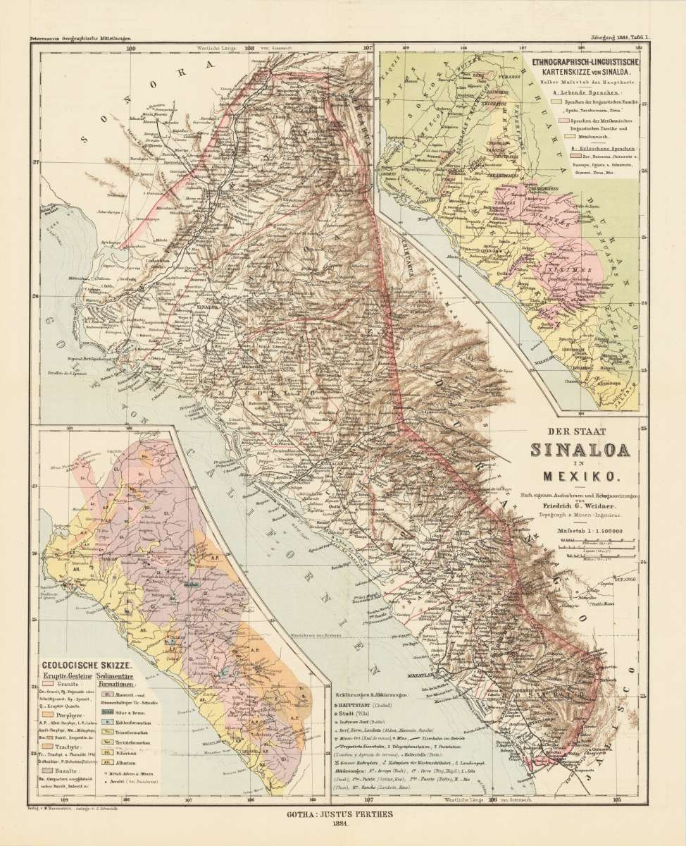
Der Staat Sinaloa in Mexiko. Nach eigenen Aufnahmen und Rekognoscirungen von Friedrich G. Weidner. Topograph &...
Petermann, A. – Sinaloa, Mexico · Lithograph, Printed in Colours · Petermanns Geographische Mitteilungen, Gotha · 1884
Eigenschaften
- Published: Gotha
- Published date: 1884
- Technique: Lithograph / Original color.
- Category: South America
- Issue date: 1884
- Type: map
- Size: 247 by 306mm (9 by 12 inches).
- Stock number: 30461
- Condition: In excellent condition.
Article description
Article description
Original antique lithograph, printed in colours, published by Justus Perthes in Gotha for 'Petermanns Geographische Mitteilungen', 1884. Lithograph, original color in outline and wash. Sheet: 247 by 306mm (9 by 12 inches).. August Heinrich Petermann (1822–1878) was one of the most important German cartographers and geographers of the 19th century. Born in Bleicherode, Saxony, he trained at the Geographische Kunstschule in Potsdam under Heinrich Berghaus — himself a leading student of Alexander von Humboldt. After a formative decade in Edinburgh and London (1845–1854), where he gained broad experience in the commercial and scientific aspects of cartography, Petermann returned to Gotha and joined the Justus Perthes publishing house. In 1855 he founded 'Petermanns Geographische Mitteilungen' (PGM), which swiftly became one of the world's foremost geographical journals — the definitive record of the great age of exploration and discovery. Petermann personally produced over 500 maps and signed 226 articles in PGM, ranging across Africa, the Polar regions, Asia, and the history and practice of cartography. In 1902, the eminent British cartographer J. G. Bartholomew wrote: 'No one has done more than he to advance modern cartography.' His maps are held in major institutions worldwide, including the Library of Congress, the British Library, and the Bibliothèque nationale de France. The detailed map depicts the state Sinaloa in Mexico with one ethnological and one geological inset map in the corner. In excellent condition.Petermann, A. – Sinaloa, Mexico · Lithograph, Printed in Colours · Petermanns Geographische Mitteilungen, Gotha · 1884
You might also be interested in the following products
 Guiana sive...
 Copper engraving, hand colored in outline and wash when published. French text edition. Decorative map extending...
€325.00
 Amér. Sep. Partie...
 Lithograph, hand-colored in outline by Vandermaelen, Phillippe Marie, published 1825 by Brussels. Image size: 470 by...
€142.00
 Süd America. Nach...
 Steel engraving, hand colored in outline when published. An antique, fine decorative map of South America with many...
€114.00
 Versuch einer...
 Copper engraving, hand colored in outline when published. This map shows the attempt by the German Cartographer...
€205.00
Recently viewed products