Beers, Frederick W.
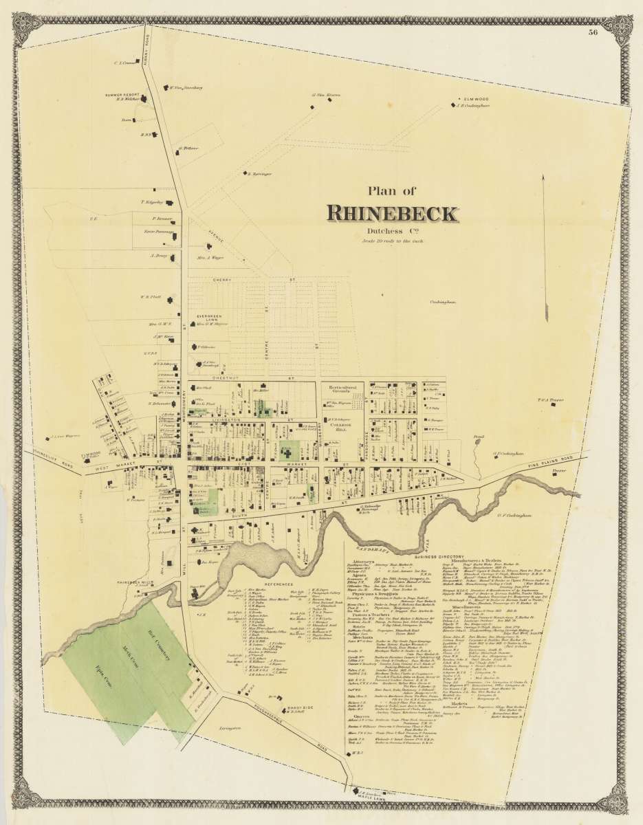
Plan of Rhinebeck Dutchess Co.
€250.00
Prices incl. VAT plus shipping costs
This item is sold. Please contact us if you are searching for this item.
Eigenschaften
- Published: New York
- Published date: 1860
- Technique: Lithograph / Original color.
- Issue date: 1860
- Type: map
- Category: State New York
- Size: 620 by 470mm (24½ by 18½ inches).
- Stock number: 19677
- Condition: The map was published folded. Therefore older folds are visible. In excellent condition.
Article description
Article description
Original antique lithograph, original color in outline and wash. Published in Beer's famous county atlas "Atlas of New York and vicinity", "a documentary record of nineteenth century life and delightful specimens of American folk art". This antique map shows a plan of Rhinebeck in a bird´s eye view. The explanation of this map is in the lower side. At the map are many place names, ground plans, etc. engraved. The paper is very fine and around the map is a very nice frame which are decorted the map.
You might also be interested in the following products
 New York. Carte...
 Copper engraving, hand colored in outline and wash. Fine engraved map of the state of New York showing various...
€250.00

 Geographisch-stat...
 Copper engraving, hand colored in outline when published. A decorative and detailed map of the state of New York....
€295.00
 Old Dutch Church...
 Original antique lithograph. Published in Beer's famous county atlas "Atlas of New York and vicinity",...
€155.00
Recently viewed products