[Geographisches Institut]
Geographisch-statistische und historische Charte von Neuyork,
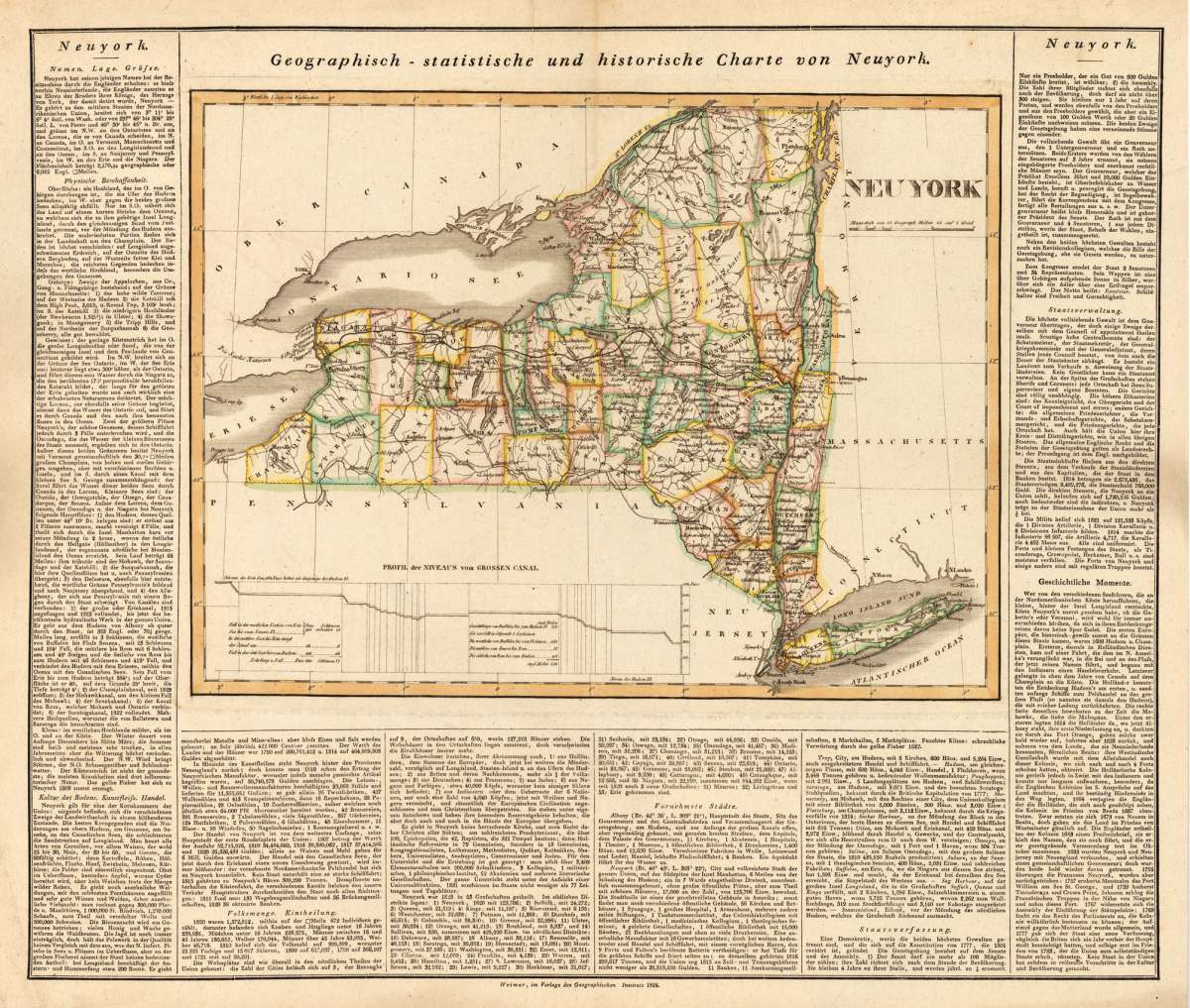
[Geographisches Institut] – Geographisch-statistische und historische Charte von Ne... · Antique Map, Copper Engraving · 300 x 400mm · Geographisches Institu...
Eigenschaften
- Published: Geographisches Institut , Weimar
- Published date: 1824
- Technique: Copper engraving / Original color.
- Type: Antique Map, map
- Issue date: 1824
- Category: New York
- Size: 300 by 400mm (11 by 15 inches).
- Stock number: 21488
- Condition: In excellent condition. 300 by 400mm (11 by 15 inches).
Article description
Article description
Copper Engraving, hand-colored in outline by [Geographisches Institut], published 1824 by Geographisches Institut, Weimar. Image size: 300 by 400mm (11 by 15 inches). The Geographisches Institut Weimar was a leading German geographical publishing house of the early 19th century, producing statistical and historical maps of the American states in the 1820s. Their maps combine careful engraving with statistical tables and historical notes, reflecting the intense German scholarly interest in the newly independent American republic and its individual state geographies. A decorative and detailed map of the state of New York. This is the rare Geerman edition of Carey & Lea's map of the state of New York, published here in Weimar around 1824. In excellent condition.[Geographisches Institut] – Geographisch-statistische und historische Charte von Ne... · Antique Map, Copper Engraving · 300 x 400mm · Geographisches Institu...
You might also be interested in the following products
 New York. Carte...
 Copper Engraving, hand-colored in outline by Buchon, Jean Alexandre, published 1825 by J. Carez, Paris. Image size:...
€250.00
 Johnson's New...
 Lithograph, original color in outline by Johnson & Ward, published 1865 by Johnson & Ward, New York. Image...
€50.00
 Old Dutch Church...
 Lithograph by Beers, F.W, published 1868 by New York. Image size: 300 by 310mm (11 by 12 inches). From Beers's...
€155.00
 Residence of A.S....
 Lithograph, original color in outline by Beers, F.W, published 1868 by Beers, F.W, New York. Image size: 300 by 310mm...
€275.00
Recently viewed products