Vandermaelen, Phillippe Marie
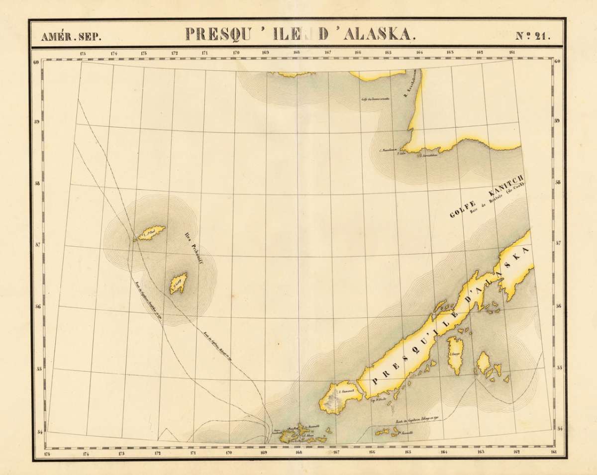
Amér. Sep. Presqu ' Ile d'Alaska. No. 21.
€128.00
Prices incl. VAT plus shipping costs
This item is sold. Please contact us if you are searching for this item.
Eigenschaften
- Published: Brussels
- Published date: 1825
- Type: Antique Map, map
- Issue date: 1825
- Technique: Lithograph / Original color.
- Category: Alaska
- Size: 473 by 573mm (18½ by 22½ inches).
- Stock number: 19723
- Condition: In excellent condition. 473 by 573mm (18½ by 22½ inches).
Article description
Article description
Lithograph, original hand colored in outline. A very large and highly detailed antique map, which shows the Alaskan Archipelago in many details. The map shows Gulf Kanitch, Island Ounga, Island Oumanak, Island St. Paul and the Island St. George. Further routes of the late eighteenth century explorers Captain Bilings (1790-91) and Captain Sarytchew (1791) are shown on the map. The map was published in Phillippe Marie Vandermaelen's atlas of North America.You might also be interested in the following products
 Views from Mt....
 Lithograph by Holmes, William Henry, published 1880 by Julius Bien & Co, New York. Image size: 480 by 765mm (19...
€195.00
 Amér. Sep. Ile De...
 Lithograph, hand-colored in outline by Vandermaelen, Phillippe Marie, published 1825 by Brussels. Image size: 487 by...
€84.00
 Amer. Sep. Grand...
 Lithograph, hand-colored in outline by Vandermaelen, Phillippe Marie, published 1825 by Brussels. Image size: 478 by...
€128.00
 Amèr. Sep. Partie...
 Lithograph, hand-colored in outline by Vandermaelen, Phillippe Marie, published 1827 by Brussels. Image size: 463 by...
€800.00
Recently viewed products