Vandermaelen, Phillippe Marie
Amér. Sep. Ile De La Reine Charlotte No. 30.
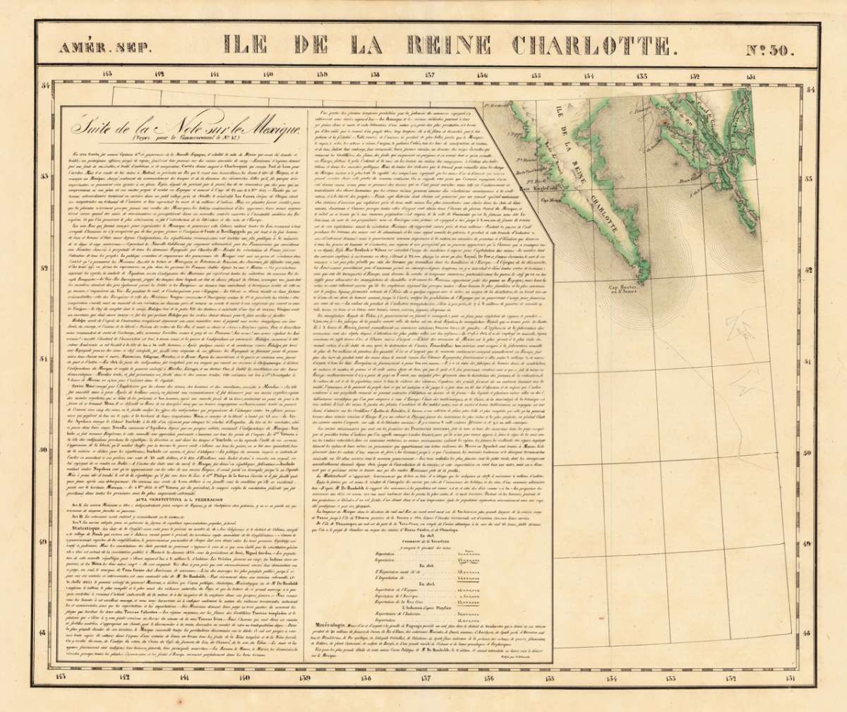
Vandermaelen, Phillippe Marie – Amér. Sep. Ile De La Reine Charlotte No. 30 · Antique Map, Lithograph · 487 x 575mm · Brussels 1825
Eigenschaften
- Published: Brussels
- Published date: 1825
- Type: Antique Map, map
- Issue date: 1825
- Technique: Lithograph / Original color.
- Category: Reine Charlotte
- Size: 487 by 575mm (19 by 22 inches).
- Stock number: 16666
- Condition: In excellent condition. 487 by 575mm (19 by 22 inches).
Article description
Article description
Lithograph, hand-colored in outline by Vandermaelen, Phillippe Marie, published 1825 by Brussels. Image size: 487 by 575mm (19 by 22 inches). A rare example from Vandermaelen's landmark Atlas universel — the first lithographic world atlas. Philippe Marie Guillaume Vandermaelen (1795–1869) was a pioneering Flemish cartographer and geographer, often called the 'Mercator of young Belgium'. Working from Brussels, he produced the groundbreaking Atlas universel (1825–1827), the first world atlas printed by lithography and the first to depict the entire globe at a single uniform scale. The atlas comprised six volumes with approximately 390 maps, representing a revolution in cartographic publishing. In 1830 Vandermaelen founded the Établissement géographique de Bruxelles, which housed Belgium's first lithographic press dedicated to cartography alongside a public library and ethnographic museum. His North American maps from the Atlas universel are prized by collectors for their accuracy, delicate lithographic detail, and their historic role as the first such images of the continent produced by the lithographic process. The map is showing the Southern part of Queen Charlotte's Island and a part of the coastline of British Columbia. Large and detailed map on Charlotte's Island, equipped with many place names and names of smaller bays along the coastline. In excellent condition.Vandermaelen, Phillippe Marie – Amér. Sep. Ile De La Reine Charlotte No. 30 · Antique Map, Lithograph · 487 x 575mm · Brussels 1825
You might also be interested in the following products
 Views from Mt....
 Lithograph by Holmes, William Henry, published 1880 by Julius Bien & Co, New York. Image size: 480 by 765mm (19...
€195.00
 Amer. Sep. Grand...
 Lithograph, hand-colored in outline by Vandermaelen, Phillippe Marie, published 1825 by Brussels. Image size: 478 by...
€128.00
 Amèr. Sep. Partie...
 Lithograph, hand-colored in outline by Vandermaelen, Phillippe Marie, published 1827 by Brussels. Image size: 463 by...
€800.00
 Amèr. Sep. Partie...
 Lithograph, hand-colored in outline by Vandermaelen, Phillippe Marie, published 1827 by Brussels. Image size: 466 by...
€1,400.00
Recently viewed products