Loew, O. Dr. & Roessler, A.R.
Originalkarte der Urwohnsitze der Azteken und Verwandten Pueblos in New Mexico. Zusammengestellt von O. Loew.
€155.00
Prices incl. VAT plus shipping costs
This item is sold. Please contact us if you are searching for this item.
Eigenschaften
- Published: J. Perthes , Gotha
- Published date: 1876
- Type: Antique Map, map
- Technique: Lithograph, later handcolor.
- Issue date: 1876
- Category: New Mexico
- Size: 250 by 193mm (9¾ by 7½ inches).
- Bibliography: Petermann's Maps #525
- Stock number: 25958
- Condition: In excellent condition. The engraving was originally published folded, so that the old folds are still slightly visible. 250 by 193mm (9¾ by 7½ inches).
Article description
Article description
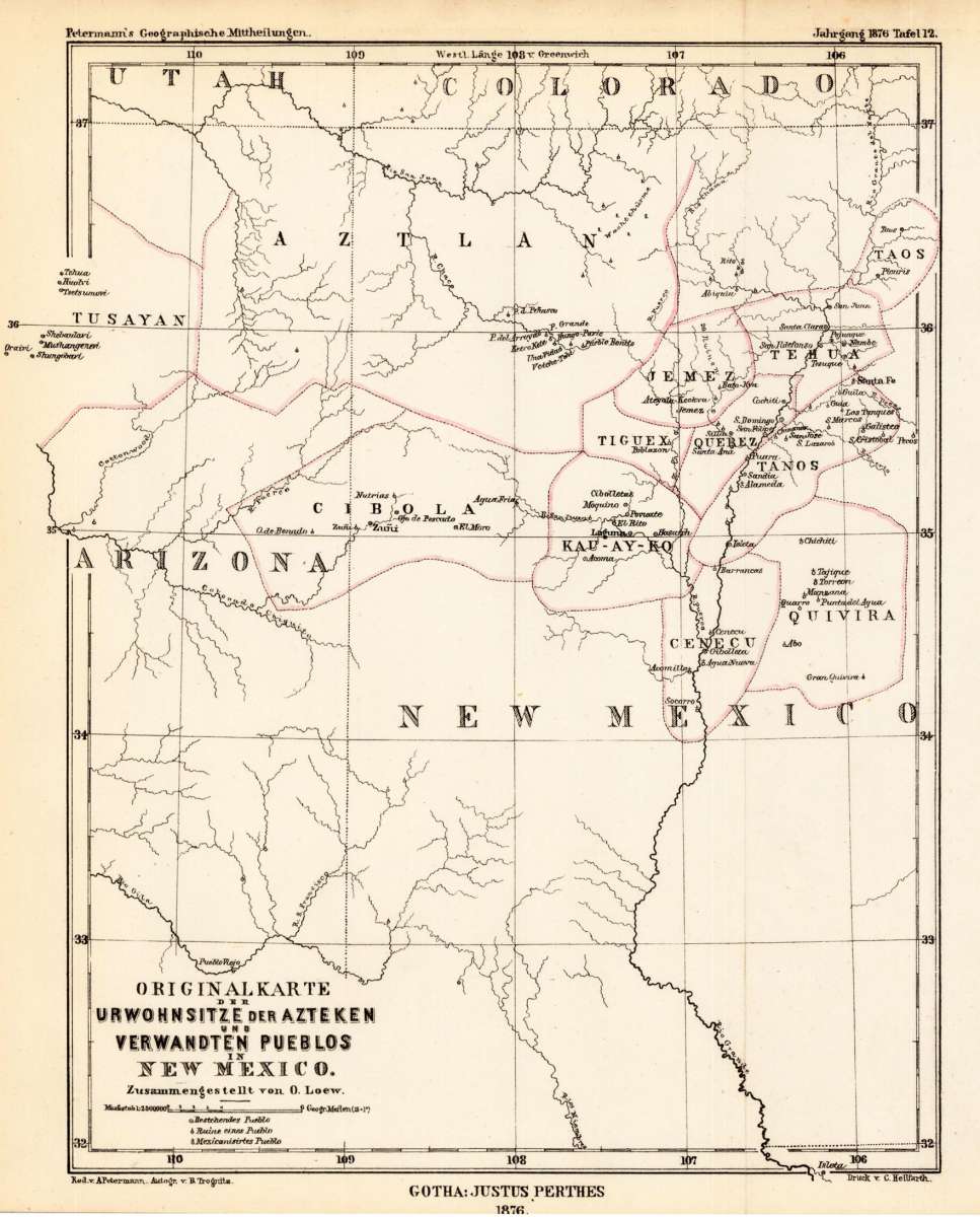
Lithograph, hand colored in outline when published. A very interesting map, which shows New Mexico and the neighbouring Arizona. The map shows the origins of the Aztecs and their related to Pueblos in New Mexico. The map is equipped with many small place names, engraved rivers, locations of existing and Mexicanized pueblos and ruins as well. Names of the regions of the old Aztecs settlements are given on the map: Aztlan, Tusayan, Cibola, Cenecu, Quivira, Kau-Ay-Ko, Tiguex, Quebez, Tanos, Jemez, Tehua and Taos.Petermann's Maps #525
You might also be interested in the following products
 Views from Mt....
 Lithograph by Holmes, William Henry, published 1880 by Julius Bien & Co, New York. Image size: 480 by 765mm (19...
€195.00
 Amér. Sep. Ile De...
 Lithograph, hand-colored in outline by Vandermaelen, Phillippe Marie, published 1825 by Brussels. Image size: 487 by...
€84.00
 Amer. Sep. Grand...
 Lithograph, hand-colored in outline by Vandermaelen, Phillippe Marie, published 1825 by Brussels. Image size: 478 by...
€128.00
 Amèr. Sep. Partie...
 Lithograph, hand-colored in outline by Vandermaelen, Phillippe Marie, published 1827 by Brussels. Image size: 463 by...
€800.00
Recently viewed products