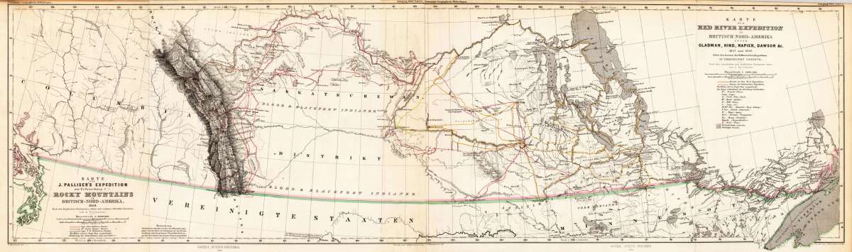
Petermann, A.
Karte von J. Palliser's Expedition zur Erfoschung der Rocky Mountains in British-Nord-America., 1858.
€175.00
Prices incl. VAT plus shipping costs
This item is sold. Please contact us if you are searching for this item.
Eigenschaften
- Published: J. Perthes , Gotha
- Published date: 1860
- Type: Antique Map, map
- Technique: Lithograph / Original color.
- Issue date: 1860
- Category: Rocky Mountains
- Size: 245 by 860mm (9¾ by 33¾ inches).
- Stock number: 25959
- Condition: In excellent condition. The map was originally published folded, so that the old folds are still slightly visible. 245 by 860mm (9¾ by 33¾ inches).
Article description
Article description
Lithograph, original hand color in outline.You might also be interested in the following products
 Views from Mt....
 Lithograph by Holmes, William Henry, published 1880 by Julius Bien & Co, New York. Image size: 480 by 765mm (19...
€195.00
 Amér. Sep. Ile De...
 Lithograph, hand-colored in outline by Vandermaelen, Phillippe Marie, published 1825 by Brussels. Image size: 487 by...
€84.00
 Amer. Sep. Grand...
 Lithograph, hand-colored in outline by Vandermaelen, Phillippe Marie, published 1825 by Brussels. Image size: 478 by...
€128.00
 Amèr. Sep. Partie...
 Lithograph, hand-colored in outline by Vandermaelen, Phillippe Marie, published 1827 by Brussels. Image size: 463 by...
€800.00
Recently viewed products