Bellin, Nicolaus
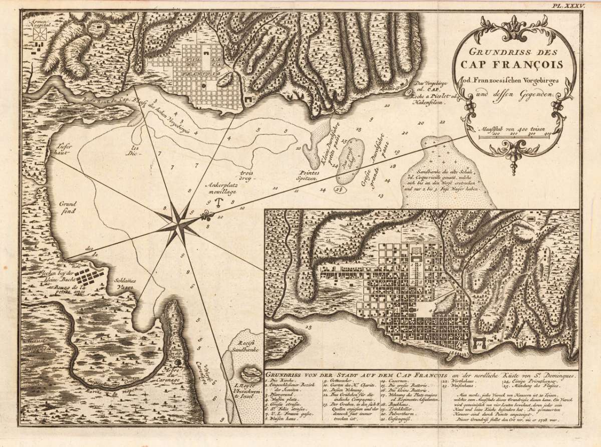
Grundriss des Cap Francois od. Franzoesischen Vorgebirges und dessen Gegenden.
€55.00
Prices incl. VAT plus shipping costs
This item is sold. Please contact us if you are searching for this item.
Eigenschaften
- Published: Merkur , Leipzig
- Published date: 1752
- Type: Antique Map, map
- Technique: Copper engraving / Uncolored
- Issue date: 1752
- Category: Cap Francois
- Size: 231 by 311mm (9 by 12¼ inches).
- Stock number: 18484
- Condition: In excellent condition. 231 by 311mm (9 by 12¼ inches).
Article description
Article description
Copper engraving, uncolored as published. Detailed map showing the bay of 'Cap Francois' with an inset map of the city of Cap Francois. Below a table of explanations. On the map we find details like depths in the sea, sand banks, anchor places, etc. Detailed and interesting map engraved by Bellin after earlier voyages.You might also be interested in the following products
 Specialkarte vom...
 Lithograph, printed in colors when published. Detailled map, showing the Chonos Archipel from the gulf of Penas with...
€132.00

 Fretum Magellanicum
 Copper engraving, uncolored as published.Original antique copper engraving, uncolored as published. A fine copy in a...
€275.00
 Falkland Islands...
 Steel engraving, hand colored in outline and wash. Decorative engraving showing the Falkland Islands and Patagonia,...
€250.00
Recently viewed products