Visscher, Nicolaus
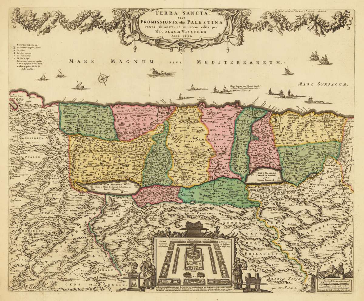
Terra Sancta, sive Promissionis, olim Palestina recens delineata, et in lucem edita per Nicolaum Visscher Anno 1659....
Eigenschaften
- Published: Amsterdam
- Published date: 1720
- Issue date: 1700-20
- Technique: Copper engraving / Original color
- Type: map
- Category: Terra Sancta
- Size: 466 by 567mm (18¼ by 22¼ inches).
- Stock number: 30586
- Condition: In excellent condition.
Article description
Article description
Copper engraving, hand colored in outline and wash when published. Old colored decorative antique map of Nicolaus Visscher's map of the Holy Land published by Petrus Schenk the younger ca. 1700-20 in Amsterdam. This rare map is orientated to the West and shows the Holy Land divided up with the different,Tribes of Israel'. Along the coast of the Mediterrarean Sea are several ships and a compass rose used. The highly decorative title cartouche is ornated with puttos and floral decorations. On the left side side to it the,Notarum explicatio', a table listing with explanations for the various sizes of the cities and towns on the map. At the bottom we find in the centre a bird's eye view with the encampment of various tribes of Israel with the tabernacle in the middle. Allegoric figures (Moses and Aaron) tp the left and right. In the lower right corner a mileage scale with two people reading geographic books. Overall a beautiful old hand colored example of this important Dutch map of the Holy Land published in the 2nd half of the 17th century in Amsterdam.You might also be interested in the following products
 Moluccae Insulae...
 Original antique copper engraving, hand colored in outline and wash when published. A highly decorative map of the...
€550.00
 Pascaert van...
 Original antique copper engraving, uncolored as published. Detailed chart of the Northeastern part of Canada,...
€1,750.00
 Pascaarte vande...
 Copper Engraving, uncolored by van Keulen, Joan, published 1684-1704 by Johannes van Keulen, Amsterdam. Image size:...
€1,100.00
 Pas kaart Van de...
 Original antique copper engraving, finely hand colored in outline and wash, probably later hand color. Detailed...
€750.00
Recently viewed products