Petermann, A.
Polynesien und der grosse Ocean im Maassstabe von 1:40.000.000. (Östliches Blatt) Von A. Petermann.
Petermann, A. – Polynesia · Lithograph, Hand Coloured · Petermanns Geographische Mitteilungen, Gotha · 1869
Eigenschaften
- Published: Justus Perthes , Gotha
- Published date: 1869
- Type: Antique Map, map
- Technique: Lithograph / Original color.
- Issue date: 1869
- Category: Polynesia, Australia & the Pacific
- Size: 332 by 400mm (13 by 15¾ inches).
- Stock number: 25232
- Condition: In excellent condition. 332 by 400mm (13 by 15¾ inches).
Article description
Article description
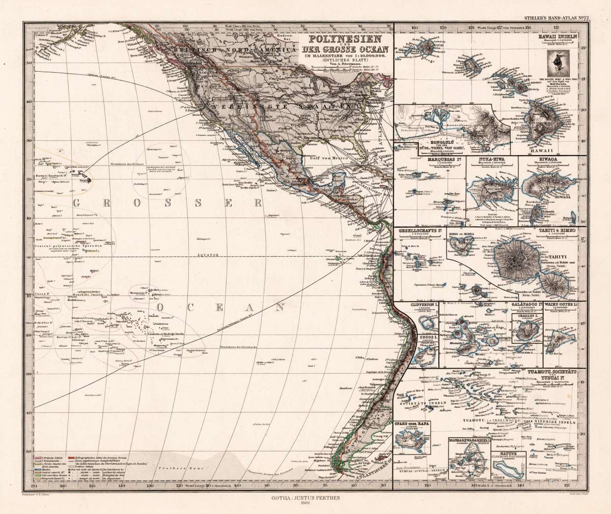
Original antique lithograph, hand coloured, published by Justus Perthes in Gotha for 'Petermanns Geographische Mitteilungen', 1869. Original lithograph, hand colored in outline and wash when published. Sheet: 332 by 400mm (13 by 15¾ inches).. August Heinrich Petermann (1822–1878) was one of the most important German cartographers and geographers of the 19th century. Born in Bleicherode, Saxony, he trained at the Geographische Kunstschule in Potsdam under Heinrich Berghaus — himself a leading student of Alexander von Humboldt. After a formative decade in Edinburgh and London (1845–1854), where he gained broad experience in the commercial and scientific aspects of cartography, Petermann returned to Gotha and joined the Justus Perthes publishing house. In 1855 he founded 'Petermanns Geographische Mitteilungen' (PGM), which swiftly became one of the world's foremost geographical journals — the definitive record of the great age of exploration and discovery. Petermann personally produced over 500 maps and signed 226 articles in PGM, ranging across Africa, the Polar regions, Asia, and the history and practice of cartography. In 1902, the eminent British cartographer J. G. Bartholomew wrote: 'No one has done more than he to advance modern cartography.' His maps are held in major institutions worldwide, including the Library of Congress, the British Library, and the Bibliothèque nationale de France. Detailed map showing the Pacific with the westcoast of the Americas. The political borders of these regions are shown on the map in different outline colors. A detailed map of the Pacific, which is showing as well sea routes from California to Australia. In excellent condition.Petermann, A. – Polynesia · Lithograph, Hand Coloured · Petermanns Geographische Mitteilungen, Gotha · 1869
You might also be interested in the following products
 Die Diebs Insel....
 Copper-engraving, handcolored in wash and outline. Map of the Larron Islands near the Archipel de St. Lazare, also...
€95.00
 Isles de la Reine...
 Original antique copper engraving, uncolored as published. This interesting map is based on Cook's voyages, and...
€95.00
 Isles des...
 Original antique copper engraving, uncolored as published. This decorative map of New Caledonia and Vanuatu shows...
€95.00
 Carte des...
 Original antique copper engraving, uncolored as published. Interesting antique map of Papua New Guinea and the...
€95.00
Recently viewed products