Petermann, A.
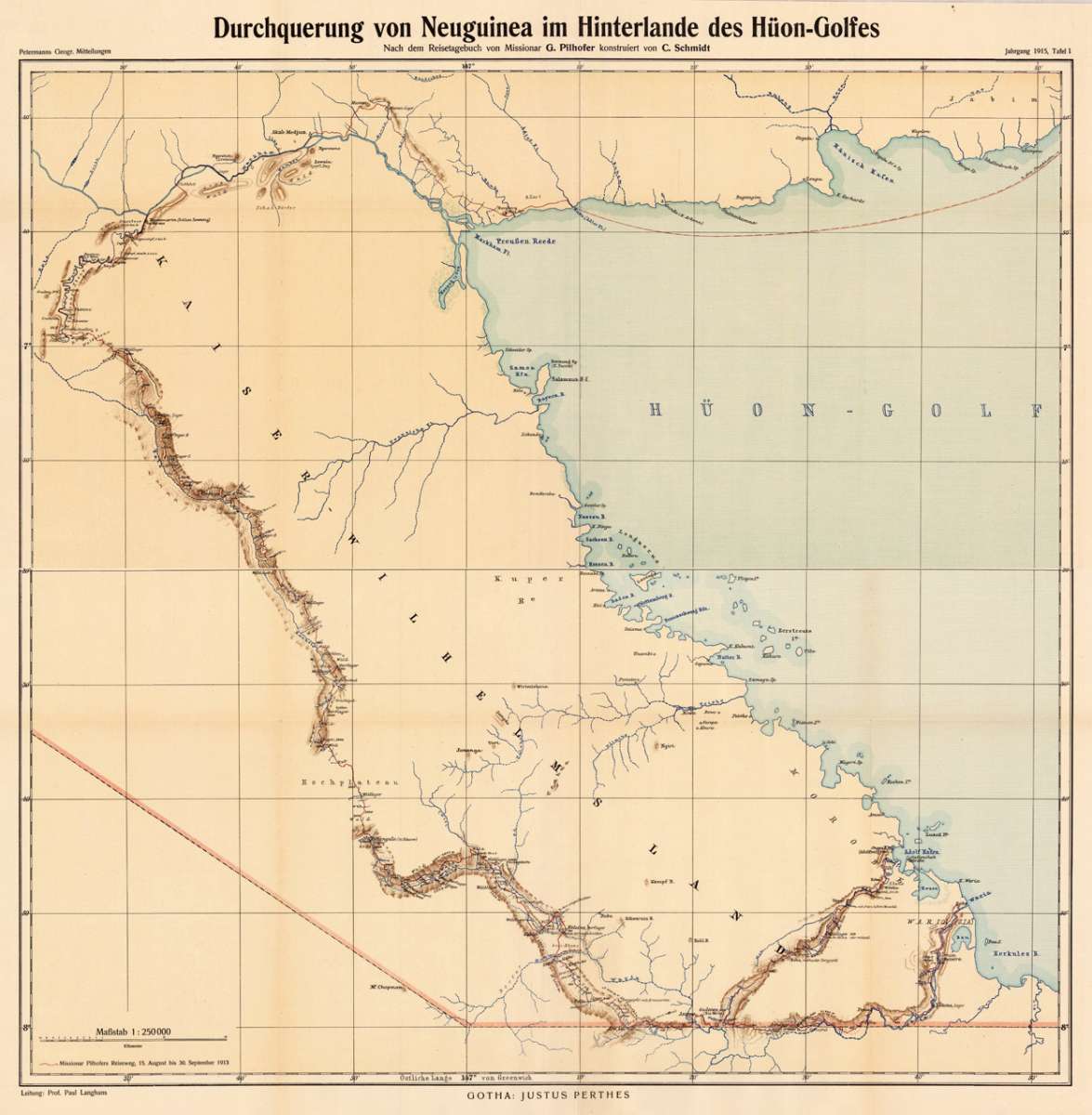
Durchquerung von Neuguinea im Hinterlande des Hüon-Golfes - Nach dem Reisetagebuch von Missionar G. Pilhofer...
Petermann, A. – New Guinea · Lithograph, Printed in Colours · Petermanns Geographische Mitteilungen, Gotha · 1915
Eigenschaften
- Published: Justus Perthes. , Gotha
- Published date: 1915
- Type: Antique Map, map
- Technique: Lithograph, printed in colors
- Issue date: 1915
- Category: Papua New Guinea
- Size: 670 by 685mm (26½ by 27 inches).
- Stock number: 19245
- Condition: In excellent condition. The map was originally published folded, so that the old folds are still slightly visible.
Article description
Article description
Original antique lithograph, printed in colours, published by Justus Perthes in Gotha for 'Petermanns Geographische Mitteilungen', 1915. Lithograph, original color in outline and wash. Sheet: 670 by 685mm (26½ by 27 inches).. August Heinrich Petermann (1822–1878) was one of the most important German cartographers and geographers of the 19th century. Born in Bleicherode, Saxony, he trained at the Geographische Kunstschule in Potsdam under Heinrich Berghaus — himself a leading student of Alexander von Humboldt. After a formative decade in Edinburgh and London (1845–1854), where he gained broad experience in the commercial and scientific aspects of cartography, Petermann returned to Gotha and joined the Justus Perthes publishing house. In 1855 he founded 'Petermanns Geographische Mitteilungen' (PGM), which swiftly became one of the world's foremost geographical journals — the definitive record of the great age of exploration and discovery. Petermann personally produced over 500 maps and signed 226 articles in PGM, ranging across Africa, the Polar regions, Asia, and the history and practice of cartography. In 1902, the eminent British cartographer J. G. Bartholomew wrote: 'No one has done more than he to advance modern cartography.' His maps are held in major institutions worldwide, including the Library of Congress, the British Library, and the Bibliothèque nationale de France. The map shows the crossing of New Guinea in the back land the Huon Gulf, which is a large inlet of the Solomon Sea, in the southwestern Pacific. With detailed information along the coast and on the various rivers. In excellent condition. The map was originally published folded, so that the old folds are still slightly visible.Petermann, A. – New Guinea · Lithograph, Printed in Colours · Petermanns Geographische Mitteilungen, Gotha · 1915
You might also be interested in the following products
 Macfarlane´s...
 Original lithograph in colors, when published. Detailled map showing the expedition of MacFarlane in southern New...
€50.00
 Stromkarte von...
 Original antique lithograph, printed in colours, published by Justus Perthes in Gotha for 'Petermanns...
€55.00
 Langhans:...
 Original antique lithograph, printed in colours, published by Justus Perthes in Gotha for 'Petermanns...
€50.00
 Charte von Nieder...
 Original antique copper engraving, hand colored in outline and wash when published. Original antique map of the...
€175.00
Recently viewed products