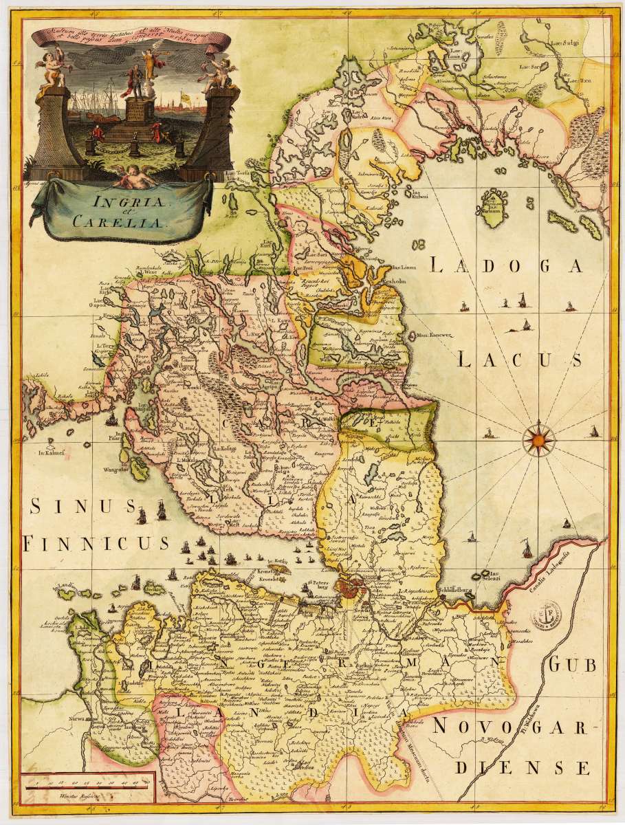
L'Isle, Joseph Nicolas de
Ingria et Carelia
Eigenschaften
- Published: Paris
- Published date: 1741
- Issue date: 1741
- Technique: Copper engraving / Original color
- Type: map
- Category: Russland, St Petersburg
- Size: 660 by 480mm (26 by 19 inches).
- Stock number: 29895
- Condition: Cut close to engraved borders of the map, else in very good condition.
Article description
Article description
Original copper engraving, hand colored in wash and outline. The decorative map depicts roads, rivers, waterways, administrative boundaries, monasteries, vegetation, and sailing ships. The title cartouche with statue of Peter the Great and a view of St.Petersburg. Title in Latin. A fine map from the first Russian atlas, centered around Crimea. The French astronomer and cartographer Joseph Nicolas Delisle (1688-1768) was called by the Czar Peter the Great to Saint Petersburg to create and run the school of astronomy. In 1740 he undertook an expedition to Siberia with the object of observing from Beryozovo the transit of Mercury across the sun. Back in Saint Petersburg he was encouraged to realize Peter the Great's project of a Russian atlas, which was carried out under the reign of Empress Anna. The famous Atlas Rossicus with maps in Cyrillic and Latin script was the result; it is a landmark in the surveying and represention of the vast Empire with reliable maps. The Saint Petersburg cartographer and military leader Carl von Frauendorff drew this map showing the location of the Russian-Turkish War, which had been triggered by raids of the Crimean Tartars on the Cossack Hetmanate at the end of 1735 and the Crimean Khan's military campaign in the Caucasus. At the beginning of summer of 1736, the Russian Dniepr Army under the command of Field Marshal von Münnich responded by taking the Crimean fortifications at Perekop, occupying Bakhchysarai, and defeating the Crimean khans. This map was frequently included in De l'Isle's atlas, and was distributed on its own. Frauendorff was Imperial Russian major general (1731-1763) and the first governor of the Irkutsk province.You might also be interested in the following products
 Moluccae Insulae...
 Original antique copper engraving, hand colored in outline and wash when published. A highly decorative map of the...
€550.00
 Pascaert van...
 Original antique copper engraving, uncolored as published. Detailed chart of the Northeastern part of Canada,...
€1,750.00
 Pascaarte vande...
 Copper Engraving, uncolored by van Keulen, Joan, published 1684-1704 by Johannes van Keulen, Amsterdam. Image size:...
€1,100.00
 Guiana sive...
 Copper engraving, hand colored in outline and wash when published. French text edition. Decorative map extending...
€325.00
Recently viewed products