Petermann, A.
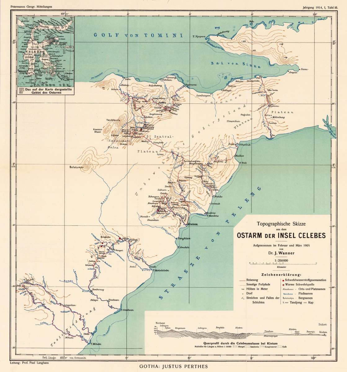
Topographische Skizze aus dem Ostarm der Insel Celebes. Aufgenommen im Februar und März 1905 von Dr. J. Wagner
Petermann, A. – Sulawesi (Celebes) · Lithograph, Printed in Colours · Petermanns Geographische Mitteilungen, Gotha · 1914
Eigenschaften
- Published: Justus Perthes. , Gotha
- Published date: 1914
- Type: Antique Map, map
- Technique: Lithograph / Original color.
- Issue date: 1914
- Category: Celebes Island
- Size: 415 by 387mm (16¼ by 15¼ inches).
- Stock number: 19242
- Condition: In excellent condition. The map was originally published folded, so that the old folds are still slightly visible. 415 by 387mm (16¼ by 15¼ inches).
Article description
Article description
Original antique lithograph, printed in colours, published by Justus Perthes in Gotha for 'Petermanns Geographische Mitteilungen', 1914. Lithograph, original color as published. Sheet: 415 by 387mm (16¼ by 15¼ inches).. August Heinrich Petermann (1822–1878) was one of the most important German cartographers and geographers of the 19th century. Born in Bleicherode, Saxony, he trained at the Geographische Kunstschule in Potsdam under Heinrich Berghaus — himself a leading student of Alexander von Humboldt. After a formative decade in Edinburgh and London (1845–1854), where he gained broad experience in the commercial and scientific aspects of cartography, Petermann returned to Gotha and joined the Justus Perthes publishing house. In 1855 he founded 'Petermanns Geographische Mitteilungen' (PGM), which swiftly became one of the world's foremost geographical journals — the definitive record of the great age of exploration and discovery. Petermann personally produced over 500 maps and signed 226 articles in PGM, ranging across Africa, the Polar regions, Asia, and the history and practice of cartography. In 1902, the eminent British cartographer J. G. Bartholomew wrote: 'No one has done more than he to advance modern cartography.' His maps are held in major institutions worldwide, including the Library of Congress, the British Library, and the Bibliothèque nationale de France. This lithograph, printed in colours from 'Petermanns Geographische Mitteilungen' focuses on Sulawesi (Celebes). Published in 1914 by Justus Perthes, Gotha, it exemplifies Petermann's exacting approach: drawing on the latest expedition reports, survey data, and geographical literature to produce maps of unrivalled scientific accuracy for their time. PGM maps from this period are highly sought after by collectors of exploration history, scientific cartography, and antique maps of the regions they depict. In excellent condition. The map was originally published folded, so that the old folds are still slightly visible.Petermann, A. – Sulawesi (Celebes) · Lithograph, Printed in Colours · Petermanns Geographische Mitteilungen, Gotha · 1914
You might also be interested in the following products
 Moluccae Insulae...
 Original antique copper engraving, hand colored in outline and wash when published. A highly decorative map of the...
€550.00
 Insularum...
 Original antique copper engraving, hand colored in outline when published. Sea chart of the Molucca Islands, the...
€425.00
 Het eiland Java...
 Original copper-engraving, uncoloured as published. This antique map shows Java. In the left lower cartouche we...
€295.00
 De Moluccos en...
 Original copper-engraving, uncoloured as published. A very decorative antique map, which shows Molukken. In the...
€295.00
Recently viewed products