Petermann, A.
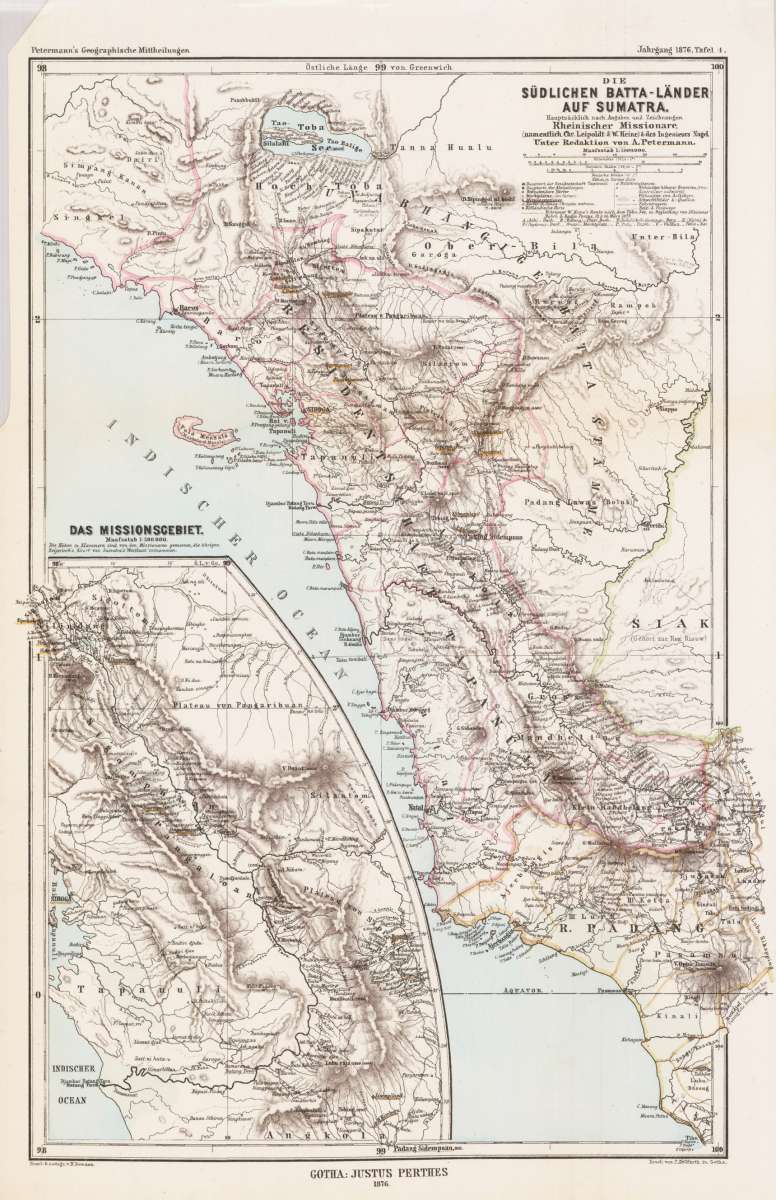
Die südlichen Batta-Länder auf Sumatra. Hauptsächlich nach Angaben und Zeichnungen Rheinischer Missionare,...
Petermann, A. – Sumatra · Lithograph, Hand Coloured · Petermanns Geographische Mitteilungen, Gotha · 1876
Eigenschaften
- Published: Gotha
- Published date: 1876
- Technique: Lithograph / Original color.
- Issue date: 1876
- Category: Sumatra
- Type: map
- Size: 363 by 250mm (14¼ by 9¾ inches).
- Stock number: 27180
- Condition: In excellent condition. The map was originally folded, so that the old folds are still slightly visable.
Article description
Article description
Original antique lithograph, hand coloured, published by Justus Perthes in Gotha for 'Petermanns Geographische Mitteilungen', 1876. Original lithograph, handcolored in outline and wash when published. Sheet: 363 by 250mm (14¼ by 9¾ inches).. August Heinrich Petermann (1822–1878) was one of the most important German cartographers and geographers of the 19th century. Born in Bleicherode, Saxony, he trained at the Geographische Kunstschule in Potsdam under Heinrich Berghaus — himself a leading student of Alexander von Humboldt. After a formative decade in Edinburgh and London (1845–1854), where he gained broad experience in the commercial and scientific aspects of cartography, Petermann returned to Gotha and joined the Justus Perthes publishing house. In 1855 he founded 'Petermanns Geographische Mitteilungen' (PGM), which swiftly became one of the world's foremost geographical journals — the definitive record of the great age of exploration and discovery. Petermann personally produced over 500 maps and signed 226 articles in PGM, ranging across Africa, the Polar regions, Asia, and the history and practice of cartography. In 1902, the eminent British cartographer J. G. Bartholomew wrote: 'No one has done more than he to advance modern cartography.' His maps are held in major institutions worldwide, including the Library of Congress, the British Library, and the Bibliothèque nationale de France. The map shows the southern 'Batta countries' on Sumatra, after notes of missionares from Germany, mainly Chr. Leipoldt & W. Heine and the Ing. Nagel. With an inset map of the mission regions. In excellent condition. The map was originally folded, so that the old folds are still slightly visable.Petermann, A. – Sumatra · Lithograph, Hand Coloured · Petermanns Geographische Mitteilungen, Gotha · 1876
You might also be interested in the following products
 Moluccae Insulae...
 Original antique copper engraving, hand colored in outline and wash when published. A highly decorative map of the...
€550.00
 Insularum...
 Original antique copper engraving, hand colored in outline when published. Sea chart of the Molucca Islands, the...
€425.00
 Het eiland Java...
 Original copper-engraving, uncoloured as published. This antique map shows Java. In the left lower cartouche we...
€295.00
 De Moluccos en...
 Original copper-engraving, uncoloured as published. A very decorative antique map, which shows Molukken. In the...
€295.00
Recently viewed products