Petermann, A.
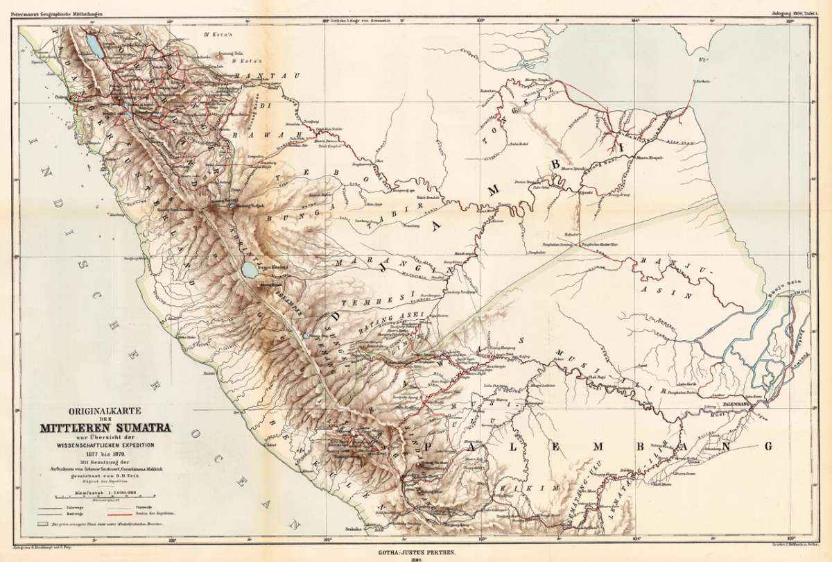
Originalkarte des mittleren Sumatra zur Übersicht der wissenschaftlichen Expedition 1877 bis 1879. - Mit Benutzung...
Eigenschaften
- Published: Justus Perthes , Gotha
- Published date: 1880
- Type: Antique Map, map
- Issue date: 1880
- Category: Sumatra
- Technique: Lithograph / Original color
- Size: 380 by 580mm (15 by 22¾ inches).
- Stock number: 28930
- Condition: In excellent condition. The map was originally folded, so that the old folds are still slightly visable. 380 by 580mm (15 by 22¾ inches).
Article description
Article description
Lithograph, original color in outline and wash. Detailled map of central Sumatra, providing an overview of the scientific expedition 1877-79. Using the mappings by Schouw Santvoort, Cornelissen and Makkink. The map is providing an enormous amount on information on the river system, the mountains and trails in Sumatra. A detailled map.You might also be interested in the following products
 Moluccae Insulae...
 Original antique copper engraving, hand colored in outline and wash when published. A highly decorative map of the...
€550.00
 Insularum...
 Original antique copper engraving, hand colored in outline when published. Sea chart of the Molucca Islands, the...
€425.00
 Het eiland Java...
 Original copper-engraving, uncoloured as published. This antique map shows Java. In the left lower cartouche we...
€295.00
 De Moluccos en...
 Original copper-engraving, uncoloured as published. A very decorative antique map, which shows Molukken. In the...
€295.00
Recently viewed products