Tallis, J & F.
France.
€50.00
Prices incl. VAT plus shipping costs
This item is sold. Please contact us if you are searching for this item.
Eigenschaften
- Published: John Tallis & Company , London & New York
- Published date: 1851
- Type: Antique Map, map
- Issue date: 1851
- Category: France
- Technique: Steel engraving, hand colored.
- Size: 252 by 317mm (10 by 12½ inches).
- Stock number: 29649
- Condition: In excellent condition.
Article description
Article description
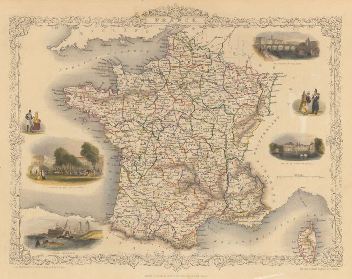
Steel engraving, hand colored in outline and wash. A decorative antique map of France with many details. We do find engraved place names, rivers, lakes, islands and mountains. The map is decorated with six finely hand colored engraved vignette city views: the bridge of Toulouse, the Palace of Fontainebleau, Calais Harbour and the garden of the Palais Royal. The actual map was drawn and engraved by J. Rapkin. The illustrations were engraved by various artists: R. Radclyffe, W. Lacy, J. Rogers, J. H. Kernot, J. B. Allen, T. Fleming, H. Winkles, R. Baker after drawings by H. Warren, H. Winkles and H. Wray.You might also be interested in the following products
 Artesia
 Original antique copper engraving, hand coloured when published, depicting Artois. Published by M. Seutter, Augsburg,...
€145.00
 Artesia. Iacobo...
 Original antique copper engraving, hand coloured when published, depicting Artois. Published in Antwerpen, 1588....
€295.00
 Elsass
 Original antique copper engraving, hand coloured when published, depicting Elsass - Alsatia. Published by Jodocus...
€240.00
 Li contorni di...
 Original antique copper engraving, hand coloured when published, depicting Paris. Published by Antonio Zatta.,...
€180.00
Recently viewed products