S. D. U. K.
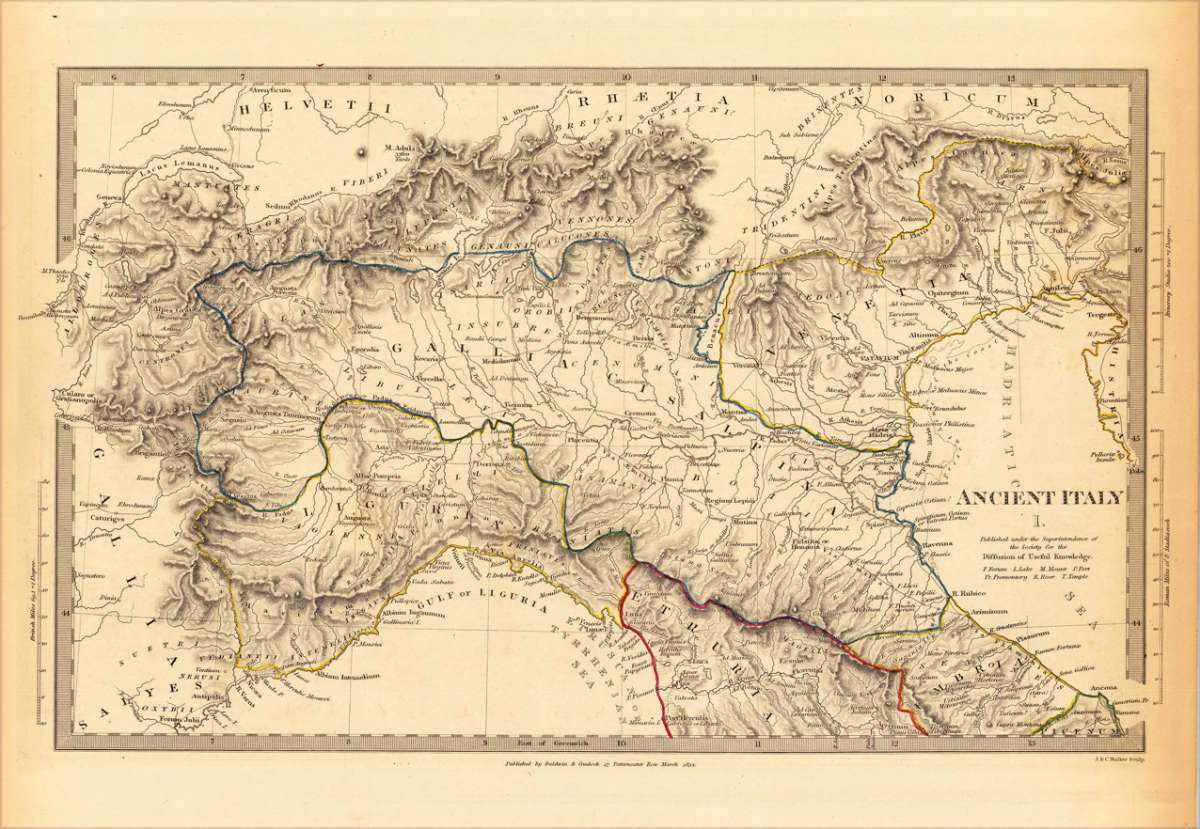
Ancient Italy I. - Published under the Superintendence of the Society for the Diffusion of Useful Knowledge
F. Forum, L. Lake, M. Mount, P. Port, Pr. Promontory, R. River, T. Temple
€35.00
Prices incl. VAT plus shipping costs
This item is sold. Please contact us if you are searching for this item.
Eigenschaften
- Published: Baldwin & Cradock , London
- Published date: 1832
- Type: Antique Map, map
- Technique: Steel engraving, hand colored
- Category: Italy
- Issue date: 1832
- Size: 228 by 365mm (9 by 14¼ inches).
- Stock number: 20058
- Condition: In excellent condition. 228 by 365mm (9 by 14¼ inches).
Article description
Article description
Steel engraving, hand colored in outline when published. This decorative map shows Italy. Some regions are engraved which are Gallia, Salyes, Liguria, Gallia Cisalpina, Etruria, Venetia, Helvetii, Rhaetia, Noricum. Inside the map are many small place names, rivers, engraved. At the map also to see is the Gulf of Liguria and the Hadriantic Sea. Along the coast are many place names engraved. At the left and right side from the map are mileage scale to see.F. Forum, L. Lake, M. Mount, P. Port, Pr. Promontory, R. River, T. Temple
You might also be interested in the following products
 Pedemontanae...
 Original antique copper engraving, uncolored, from the 'Theatrum Orbis Terrarum' by Abraham Ortelius, the...
€650.00
 Ora Baiana et...
 Original antique hand-colored copper engraving, published 1719. Depicting Bay of Naples, this map is a fine example...
€175.00
 Naples & Sicily
 Original antique lithograph, published 1852. Depicting Kingdom of Naples, this map is a fine example of 0s European...
€145.00
 Milane States
 Original antique hand-colored lithograph, published 1852. Depicting Milan & Lombardy, this map is a fine example...
€140.00
Recently viewed products