Cary, John
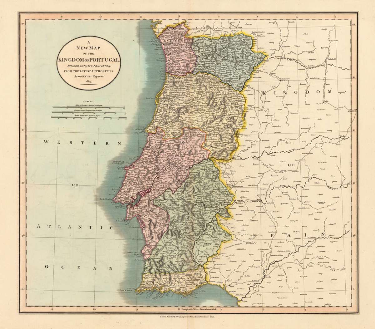
A New Map of the Kingdom of Portugal. divided into its Provinces. From the latest Authorities. By John Cary Engraver:...
€195.00
Prices incl. VAT plus shipping costs
This item is sold. Please contact us if you are searching for this item.
Eigenschaften
- Published: J. Cary , London
- Published date: 1825
- Technique: Copper engraving / Original color.
- Type: Antique Map, map
- Issue date: 1825
- Category: Portugal
- Size: 458 by 516mm (18 by 20¼ inches).
- Stock number: 19146
- Condition: In excellent condition.
Article description
Article description
Copper-engraving, hand colored in outline when published. This map shows the Kingdom of Portugal and his provinces. In the upper left corner we found the title cartouche and the mileage scale. Also is the Atlantic Ocean at the left side engraved. At the right side is the Kingdom of Spain engraved.You might also be interested in the following products
 Zahara - Bornos
 Original antique hand colored copper engraving, published in volume V of the town book "Civitates Orbis...
€480.00
 De Cust van...
 Detailled handcoloured sea-chart showing the Portugese coastline from Setubal S. Vves along the Algarve towards Palos...
€850.00
 Partie...
 Copper engraving, hand colored in outline, when published. Decorative map of Portugal. Divided up by outline color...
€245.00
 Der Thurm Belem...
 Copper engraving, hand colored in wash and outline, published in Allain Manesson Mallet's description of the...
€55.00
Recently viewed products