Chatelein, Henry Abraham
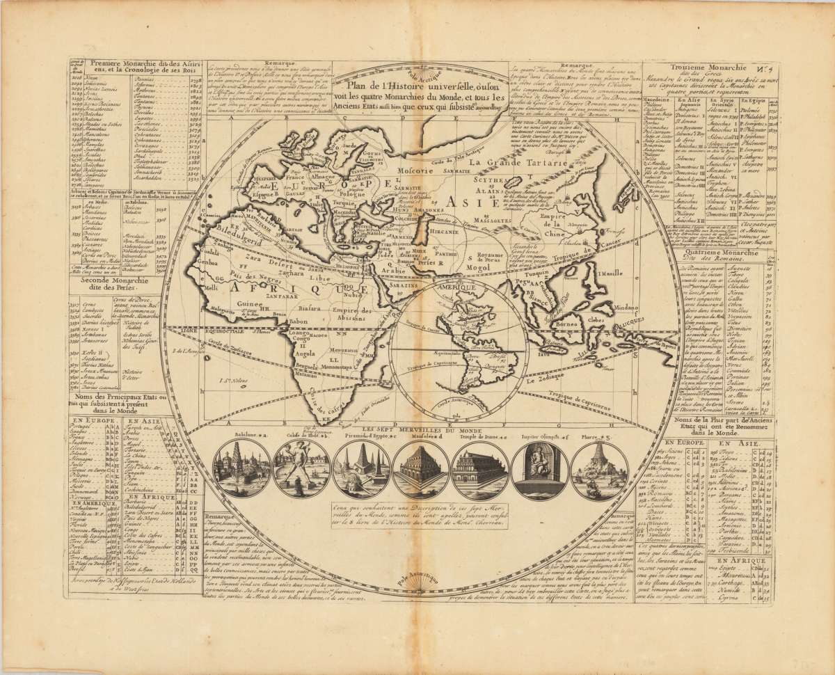
Plan de l'Histoire universelle: ou l'on voit les quatre Monarchies du Monde, et tous les Anciens Etats...
Eigenschaften
- Published: Nürnberg
- Published date: 1700
- Type: Antique Map, map
- Issue date: 1713
- Technique: Copper engraving
- Category: 7 wonders of the world
- Size: 33.5 x 44,5 cm (13.25 x 17,5 inches).
- Stock number: 35976
- Condition: In excellent condition.
Article description
Article description
Original antique copper engraving, uncolored as published. Geographical map, contained in Volume I "Atlas Historique ou nouvelle Introduction a l'Histoire, à la Chronologie & à la Geographie Ancienne & Moderne", published in Amsterdam in 1713. Atlas, which, with its publication, includes geographic maps with engravings and information of a geographic, heraldic, ethnographic and historical nature, making the work in seven volumes very innovative. Engraved map of the Eastern Hemisphere with an inset of the Western Hemisphere in the center showing California as an island. Contains tables, notes and 7 cartoons illustrating the 7 wonders of the world Henri Abraham Chatelain (1684 - 1743), a Huguenot pastor originally from Paris, lived alternately in Paris, London, The Hague and Amsterdam. Known as a Dutch cartographer for his monumental seven-volume cartographic work Atlas Historique, published with his brothers in Amsterdam.You might also be interested in the following products
 Moluccae Insulae...
 Original antique copper engraving, hand colored in outline and wash when published. A highly decorative map of the...
€550.00
 Pascaert van...
 Original antique copper engraving, uncolored as published. Detailed chart of the Northeastern part of Canada,...
€1,750.00
 Pascaarte vande...
 Copper Engraving, uncolored by van Keulen, Joan, published 1684-1704 by Johannes van Keulen, Amsterdam. Image size:...
€1,100.00
 Die Erde in zwey...
 Original antique copper engraving, hand colored in outline and wash, when published. A decorative world map by...
€350.00
Recently viewed products