The following products have been found matching your search "North Sea": 97
No results were found for the filter!
 Pascaart vande Custen Van Andaluzia, Portugal, Gallißien, Biseajen, en eengedeelt von Vranckyck, beginnen van Heysant...
 Original antique copper engraving, hand colored in outline when published. A highly decorative sea chart of Spain...
€1,450.00
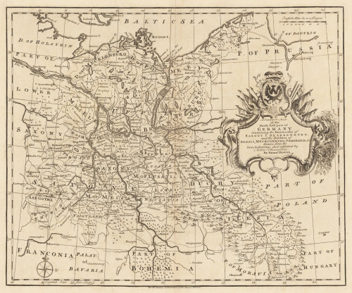
 A Correct Map of the North East Part of Germany containing the Electorates...
 Original Kupferstich, unkoloriert erschienen. Dargestellt wird der nordöstliche Teil Deutschlands mit Teilen von...
€145.00
 Das fünffte Buch Sarmartia Asie.
 Woodcut map, finely hand colored in wash by a later hand. Published in the ,Cosmographia' by Sebastian Münster...
€90.00
 Paskaart Van de Kust van Maroca Beginnende Van Larache. tot aan C. Cantin. Met syn Diepte en Droogte dus-ver...
 Original antique copper engraving, uncolored as published. Decorative early sea chart, orientated with the North to...
€395.00
 Neueste Karte von England nach den besten Quellen entworfen u. gezeichnet vom Hauptm. Radefeld. 1844
 Steelengraving, handcolored in outline when published. The detailled map of the British Isles is providing a lot of...
€80.00
 Neueste Karte von England nach den bessten Quellen entworfen u. gezeichnet vom Hauptm. Radefeld. 1844.
 Steelengraving, handcolored in outline when published. The detailled map of England is providing a lot of...
€80.00
 Penbrochia Comitatus et Co mitatus Caermardinum.
 Original antique copper engraving, hand colored in outline and wash. A fine and highly decorative map of Penbrochia,...
€345.00
 Neueste Karte von Schotland Nach den bessten Quellen entworfen u. gezeichnet vom Hauptm. Radefeld. 1844.
 Steelengraving, handcolored in outline when published. The detailled map of Scotland is providing a lot of...
€95.00
 Australien.
 Lithograph, hand colored in outline when published. This map shows Australia with the Pacific Ocean. Inside the map...
€150.00
 Erythraei Sive Rubri Maris Periplus. Olim Ab Arriano Descriptus Nunc Vero Ab. Abrah. Ortelio Ex Eodem Delineatus.
 Original antique copper engraving, hand colored in outline when published. Published in a Dutch text edition of J....
€345.00
 Totius Iutiae Generalis Accurarata delincatio.
 Original antique copper engraving, hand colored. This antique map shows Jutland with the neighboring islands Zeeland...
€490.00
 Pas-kaart van de Grand Banqu by Terra Neuff ...
 Original antique copper engraving, uncolored as published. Decorative sea chart showing Terra Nova in North East...
€645.00

