The following products have been found matching your search "british": 69
Or did you mean: britain | british isles | great britain | The British Isles | brindisi | Brixia | britische | britisches
No results were found for the filter!
 Ost-Spitzvergen und die König Karl's Inseln. gezeichnet von Dr. Willy Kükenthal.
 Lithograph, original color in outline and wash. August Heinrich Petermann (born April 18, 1822 in Bleicherode; †...
€80.00
![Banka [lower left corner Antique Banka [lower left corner with inset map: Prefecture de Banka et Billiton]](https://bergbook.com/media/image/6d/f7/a3/32005_500x500.jpg) Banka [lower left corner with inset map: Prefecture de Banka et Billiton]
Banka [lower left corner with inset map: Prefecture de Banka et Billiton] Original manuscript map in colors. This antique manuscript map shows the island of Banka (Bangka, Bangka-Belitung)...
€1,100.00
 Tabula Ducatus Britanniae Gallis le Gouvernemt. General de Bretagne insuos Novem Episcopatuss omnes Turonensi Aurel....
 Original antique copper engraving, hand colored in outline and wash when published. Shows Brittany with the offshore...
€175.00
 Arcipelago delle Antille ossia Indiae Occidentali. (America)
 Lithograph, hand colored in outline when published. Geographical map from the "Geographical Atlas with Information...
€320.00
 A New and Accurate Map of the Netherlands from the Sieur Roberts Atlas with Improvements.
 Original antique copper engraving, uncolored. Engraved by J. Gibson Original antique map showing the north-western...
€45.00
 Plan of Dieppe with the New Fortifications and Projected Works.
 Original antique copper engraving, uncolored. Original antique map of Dieppe, France, published in,The Geographical...
€65.00
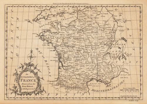
 An Accurate Map of France Drawn from the Sieur Robert, with Improvemts.
 Original antique copper engraving, uncolored. Published in London and engraved for the 'New Geographical...
€80.00
 Plan of the Town and Mole of Agde With the Fort de Brescou
 Original antique copper engraving, uncolored. Engraved by F. A. Aveline. Original antique plan of the town and mole...
€90.00
 Waterloo - Conveying the French Cannon from the Field of Battle on the 24th July 1815
 Original aquatint, hand colored in the period when published. Original aquatint published in the volume 'An...
€200.00
 Portus Pulchri in Isthmo siti accurata Ichnographia ex prototypo Londinensi. Scenographia Portus pulchri ex prototypo...
 Original antique copper engraving, hand colored in outline and wash when published. Old colored copper engraving map...
€380.00
 the large calvary
 Original woodcut, printed from four woodblocks on laid paper. 2nd state probaly around 1550 printed This is the...
€19,500.00
 The Province Ulster described.
 Original antique copper engraving, hand colored in wash and outline. Very decorative map of the County of Ulster in...
€745.00

