[F. A. Aveline]
Plan of the Town and Mole of Agde With the Fort de Brescou
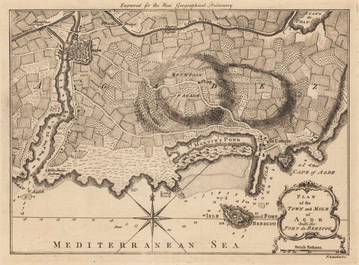
[F. A. Aveline] – Plan of the Town and Mole of Agde With the Fort de Brescou · Original Antique Copper Engraving, Uncoloured · John Hinton · London 1759
Eigenschaften
- Published: London
- Published date: 1759
- Technique: Copper engraving / Uncolored.
- Type: Book, map
- Issue date: 1759
- Category: South France
- Size: 20.3 x 27,4 cm (8 x 10,75 inches).
- Stock number: 24375
- Condition: In excellent condition.
Article description
Article description
Original antique copper engraving, hand coloured when published, depicting F.A. Aveline. Published by John Hinton, London, 1759. Sheet: 20.3 x 27,4 cm (8 x 10,75 inches).. A fine decorative example of antique cartography by [F. A. Aveline], rich in period detail and historical significance. François Antoine Aveline (1718–1780) was a French engraver and publisher based in Paris who produced a range of topographical and architectural engravings. His harbour plans and coastal views contributed to the documentation of French ports and maritime sites in the eighteenth century. Original antique plan of the town and mole of Agde, published in,The New Geographical Dictionary'. Bordered by the Mediterranean Sea, on the coastline of southern France, showing Isle and Fort Brescou in the lower part. A decorative title cartouche with the mile scale in British Fathoms in the lower right corner. In good condition for its age (published 1759). Colours well preserved. Some age-toning and minor imperfections consistent with a document of this antiquity. A condition report is available on request.[F. A. Aveline] – Plan of the Town and Mole of Agde With the Fort de Brescou · Original Antique Copper Engraving, Uncoloured · John Hinton · London 1759
You might also be interested in the following products
 Artesia
 Original antique copper engraving, hand coloured when published, depicting Artois. Published by M. Seutter, Augsburg,...
€145.00
 Artesia. Iacobo...
 Original antique copper engraving, hand coloured when published, depicting Artois. Published in Antwerpen, 1588....
€295.00
 Elsass
 Original antique copper engraving, hand coloured when published, depicting Elsass - Alsatia. Published by Jodocus...
€240.00
 Li contorni di...
 Original antique copper engraving, hand coloured when published, depicting Paris. Published by Antonio Zatta.,...
€180.00
Recently viewed products