[G. Rollos]
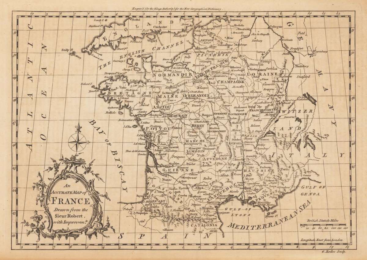
An Accurate Map of France Drawn from the Sieur Robert, with Improvemts.
Eigenschaften
- Published: London
- Published date: 1756
- Technique: Copper engraving / later handcolor
- Category: France
- Issue date: 1756
- Type: Book
- Size: 20.8 x 27,5 cm (8.25 x 10,75 inches).
- Stock number: 24412
- Condition: In excellent condition.
Article description
Article description
Original antique copper engraving, uncolored. Published in London and engraved for the 'New Geographical Dictionary'. Engraved by G. Rollos. Decorative small map of France, engraved for,The New Geographical dictionary'. A very decorative title cartouche in the lower left corner, a mile scale in British Statute Miles in the lower right corner.You might also be interested in the following products
 Artesia
 Original antique copper engraving, hand coloured when published, depicting Artois. Published by M. Seutter, Augsburg,...
€145.00
 Artesia. Iacobo...
 Original antique copper engraving, hand coloured when published, depicting Artois. Published in Antwerpen, 1588....
€295.00
 Elsass
 Original antique copper engraving, hand coloured when published, depicting Elsass - Alsatia. Published by Jodocus...
€240.00
 Li contorni di...
 Original antique copper engraving, hand coloured when published, depicting Paris. Published by Antonio Zatta.,...
€180.00
Recently viewed products