The following products have been found matching your search "entlang": 26
Or did you mean: England | Map of England | London england | new england | entstand | engeland | engelant | entlassiung
No results were found for the filter!
 Schärding
 Original Kupferstich, erschienen in der 'Topgraphia Bavariae' von Matthaeus Merian. Original Kupferstich,...
€175.00
 Die Herzögl: Gotha-Altenburgische Stadt Camburg an der Saale.
 Original Radierung, handkoloriert. Stadtansicht von Camburg an der Saale (heute Dornburg-Camburg in Thüringen) von...
€850.00
 England Bergzeichnung v. Hauptm Radefeld. 1852.
 Steel engraving, handcolored in outline, when published. Small and decorative map of England, showing many place...
€40.00
 Neueste Karte von England nach den bessten Quellen entworfen u. gezeichnet vom Hauptm. Radefeld. 1844.
 Steelengraving, handcolored in outline when published. The detailled map of England is providing a lot of...
€80.00
 England und Wales
 Lithograph, hand colored in wash and outline when published. Detailed map of England and Wales divided up into its...
€50.00
 England III. - Published under the Superintendence of the Society for the Diffusion of Useful Knowledge
 Steel engraving, hand colored in outline when published. This antique map shows England with its Northeastern part....
€30.00
 England and Wales
 Engraved map, hand colored in wash and outline, when published. Nice and detailed map of England and Wales with...
€48.00
 England & Wales
 Steel engraving, hand colored in outline and wash when published. Engraved by P.E. Hamm. This fine small engraved...
€45.00
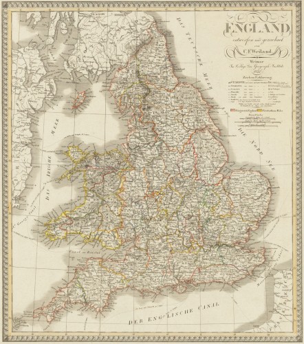
 England entworfen und gezeichnet von C. F. Weiland. Weimar, im Verlage des Geograph. Instituts 1822.
 Copper engraving, hand colored in outline when published. An old map of England depicted by the German mapmaker Carl...
€220.00
 De Custen van Engelant tusschen de twee pointen van Poortlandt en Lezard.
 Fascinating detailed seachart of the south-eastern coast of England showing the coastline from Lizard Point over...
€950.00
 A map of Continent of the East-Indies &c. Explaining what belongs to England, Spain and Holland &c. - By H....
 Copper engraving, decorative handcolored in outline. Small wide and decorative map showing the continent of India...
€375.00
 Neueste Karte von England nach den besten Quellen entworfen u. gezeichnet vom Hauptm. Radefeld. 1844
 Steelengraving, handcolored in outline when published. The detailled map of the British Isles is providing a lot of...
€80.00

