Flemming, Carl
England und Wales
Eigenschaften
- Published: C. Flemming , Glogau
- Published date: 1855
- Type: Antique Map, map
- Technique: Lithograph / Original color.
- Category: England & Wales
- Issue date: 1855-60
- Size: 392 by 345mm (15½ by 13½ inches).
- Stock number: 17911
- Condition: In excellent condition. 392 by 345mm (15½ by 13½ inches).
Article description
Article description
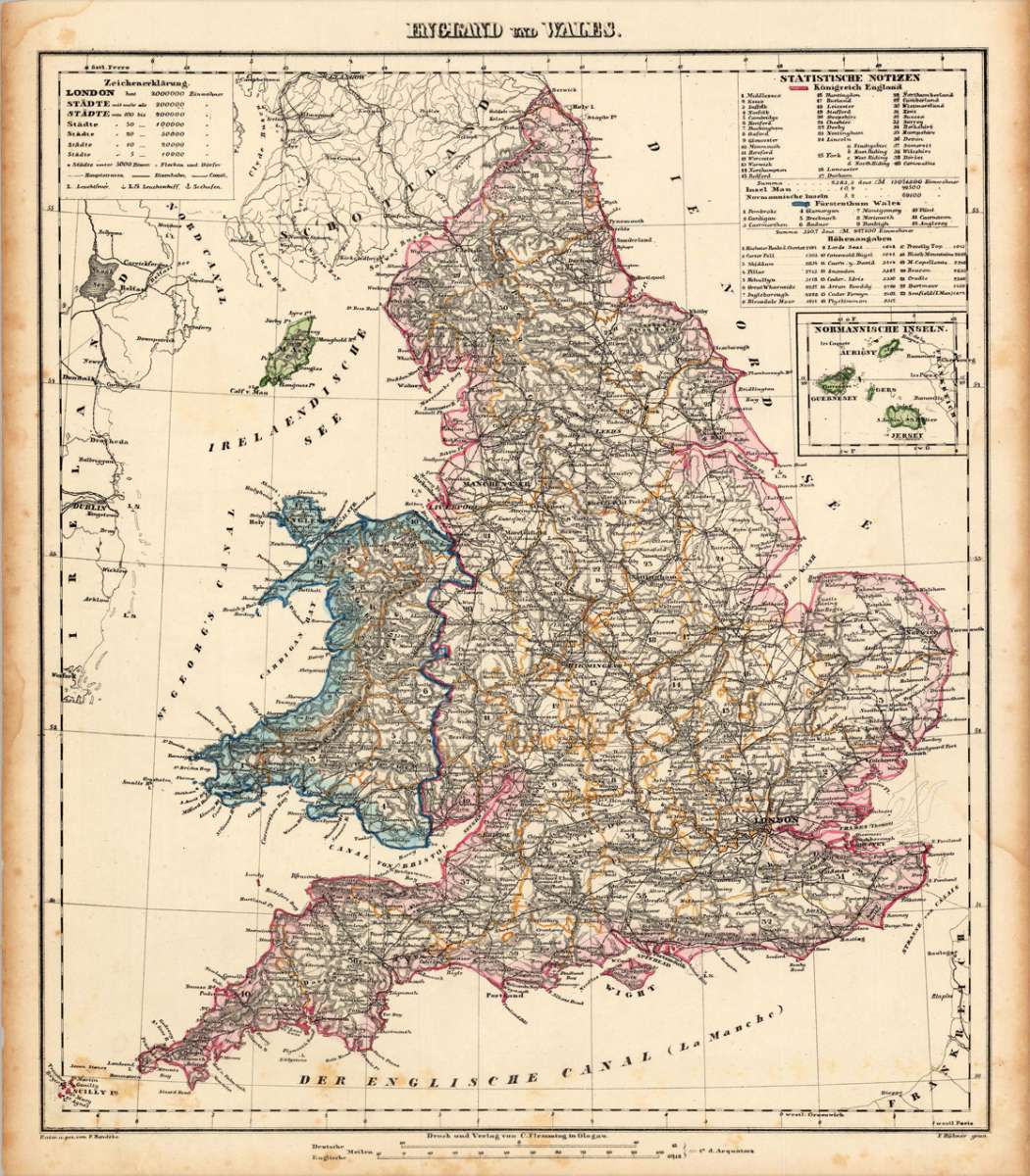
Lithograph, hand colored in wash and outline when published. Detailed map of England and Wales divided up into its counties. In the upper right corner a statistic table with an overview of the counties of the kingdom of England (colored in red) and a listing of the counties of Wales (colored in blue). Below with a table listing mountains with their heights. The map with many information on place names, castles, rivers, lakes, mountains, etc. The borders of the counties are shown in outline colors. Decorated as well with a small inset map of the 'Channel Islands' Aurigny, Guernesey, Gers and Jersey.You might also be interested in the following products

 De Custen van...
 Fascinating detailed seachart of the south-eastern coast of England showing the coastline from Lizard Point over...
€950.00
 Neueste Karte von...
 Steelengraving, handcolored in outline when published. The detailled map of the British Isles is providing a lot of...
€80.00
 Anglia Cambdeni,...
 Original antique copper engraving, hand colored in outline and wash when published. Decorative detailled map...
€195.00
Recently viewed products