The following products have been found matching your search "quentin": 30
No results were found for the filter!
 Caletensium et Bononiensium ditionis Accurata Delineatio. - Veromanduorum Eorumque confinium Exactissima Descript....
 Original copper engraving, published 1572 in an German text edition of the 'Theatrum Orbis Terrarum'. Caletensium...
€175.00
 Paskaart Van de Kust van Maroca Beginnende Van Larache. tot aan C. Cantin. Met syn Diepte en Droogte dus-ver...
 Original antique copper engraving, uncolored as published. Decorative early sea chart, orientated with the North to...
€395.00
 Joan Miro Lithographs II preface by Raymond Queneau
 Illustrated book, 11 lithographs, original color. Hard cover. First English language edition with 11, partly double...
€395.00
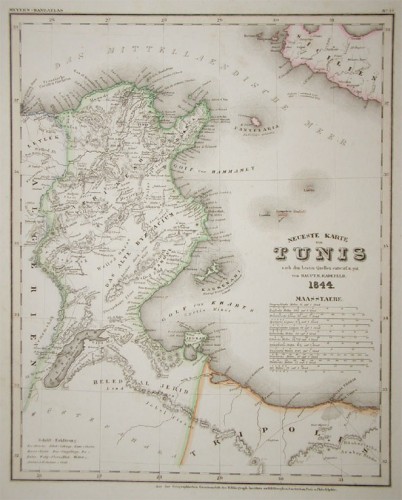
 Neueste Karte von Tunis nach den besten Quellen entworf. und gez. vom Hauptm. Radefeld.
 Steel engraving, in original colors, as published. A detailed map of Tunisia with many place names inland and along...
€80.00
 Neueste Karte von Arkansas mit seinen Canaelen Strassen & Entfernungen der Hauptpunkte. Nach den bessten Quellen...
 Steel engraving, hand colored in outline and wash when published. This antique map shows Arkansas with his canals,...
€173.00
 Neueste Karte von England nach den besten Quellen entworfen u. gezeichnet vom Hauptm. Radefeld. 1844
 Steelengraving, handcolored in outline when published. The detailled map of the British Isles is providing a lot of...
€80.00
 Neueste Karte von Grossbritannien und Ireland Nach den besten Quellen entworf. u. gezeichn. von Major Radefeld. 1850.
 Steelengraving, handcolored in outline when published. Detailled map of Great Britain and Ireland with many...
€80.00
 Neueste Karte von England nach den bessten Quellen entworfen u. gezeichnet vom Hauptm. Radefeld. 1844.
 Steelengraving, handcolored in outline when published. The detailled map of England is providing a lot of...
€80.00
 Neueste Karte von Grossbritannien und Ireland. Nach den besten Quellen entworf. u. gezeichn. von Hauptm. Radefeld....
 Steelengraving, handcolored in outline when published. Detailled map of Great Britain and Ireland with many...
€80.00
 Neueste Karte von Grossbritannien und Ireland. Nach den bessten Quellen entworf. u. gezeichn. von Hauptm. Radefeld....
 Steelengraving, handcolored in outline when published. Detailled map of Great Britain and Ireland with many...
€80.00
 Neueste Karte von Schotland Nach den bessten Quellen entworfen u. gezeichnet vom Hauptm. Radefeld. 1844.
 Steelengraving, handcolored in outline when published. The detailled map of Scotland is providing a lot of...
€95.00
 Karte der Colonie Queensland in Australien. Nach officiellen Quellen, von A. Petermann.
 Lithograph, original color as published.
€80.00

