Radefeld, Hauptmann von
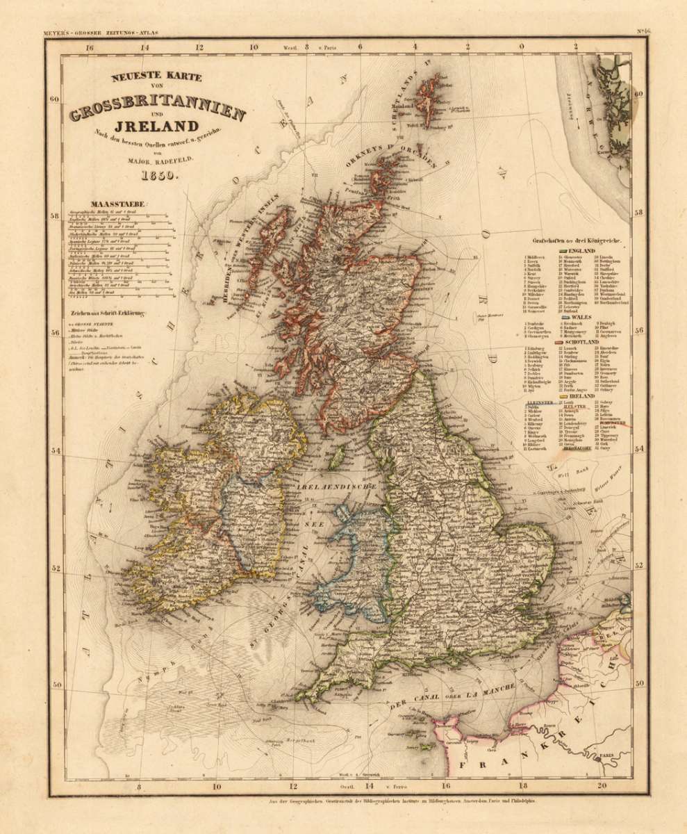
Neueste Karte von Grossbritannien und Ireland Nach den besten Quellen entworf. u. gezeichn. von Major Radefeld. 1850.
Eigenschaften
- Published: Bibliograph. Institut , Hildburghausen
- Published date: 1850
- Type: Antique Map, map
- Technique: Steel engraving, original color
- Issue date: 1850
- Category: British Isles
- Size: 380 by 300mm (15 by 11¾ inches).
- Stock number: 17454
- Condition: In excellent condition. 380 by 300mm (15 by 11¾ inches).
Article description
Article description
Steelengraving, handcolored in outline when published. Detailled map of Great Britain and Ireland with many placenames, rivers, streets and political borders. The map is equipped with a milage scale in various languages. As well four tables showing the duchies of the three kingdoms England, Scotland and Ireland.You might also be interested in the following products
 Li Regni D'...
 Copper engraving, in contemporary original color in outline. Published in Zatta's "Atlante Novissimo"....
€245.00
 General Carte von...
 Original antique copper engraving, hand colored in outline and wash, when published. Detailled map of the British...
€195.00
 Carte des Grandes...
 Copper-engraving, handcolored in outline, when published. Detailed map by the French cartographer Sr. Robert de...
€350.00
 Neueste Karte von...
 Steelengraving, handcolored in outline when published. Detailled map of Great Britain and Ireland with many...
€80.00
Recently viewed products