Smith, J. Calvin
(West Canada, Lake Huron & Lake Ontario)
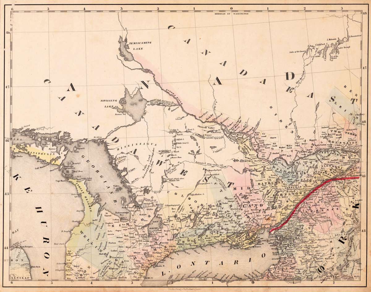
Smith, J. Calvin – (West Canada, Lake Huron & Lake Ontario) · Antique Map, Lithograph · 373 x 479mm · Th. Fischer, Cassel 1845
Eigenschaften
- Published: Th. Fischer , Cassel
- Published date: 1845
- Type: Antique Map, map
- Technique: Lithograph / Original color.
- Issue date: 1845
- Category: Canada
- Size: 373 by 479mm (14 by 18 inches).
- Stock number: 20539
- Condition: In very good to excellent condition. A few small marginal mended tears at the blank bottom (not affecting the image of the map) and a few minor marginal pin holes.
Article description
Article description
Lithograph, original color in outline by Smith, J. Calvin, published 1845 by Th. Fischer, Cassel. Image size: 373 by 479mm (14 by 18 inches). From Smith's multi-sheet Special-Karte — one of the most detailed and accurate mid-19th-century maps of the United States. John Calvin (J. Calvin) Smith (c.1809–1890) was an American surveyor, geographer, and engraver active in New York City from the 1840s. Working with partners including George Sherman (under the Sherman & Smith imprint, 1840–1853) and later in association with J.H. Colton, Smith produced some of the most accurate and widely used general-purpose maps of the United States of his era. His maps appeared in government publications, military surveys, and commercial atlases, and his multi-sheet Special-Karte der Vereinigten Staaten (published in a German-language edition) brought American cartographic standards to European audiences. Despite his prolific output and importance to American cartographic history, much of Smith's personal biography remains obscure. This decorative map shows the region from West Canada, Ottawa River towards East Canada. Detailed information on the map on Lake Ontario, the Georgian Bay, Nipissing Lake, Temiscaming Lake and the Ottawa River. Inside the map are many place names, rivers, lakes, etc. engraved. As well names on Indian tribes are given. In very good to excellent condition. A few small marginal mended tears at the blank bottom (not affecting the image of the map) and a few minor marginal pin holes.Smith, J. Calvin – (West Canada, Lake Huron & Lake Ontario) · Antique Map, Lithograph · 373 x 479mm · Th. Fischer, Cassel 1845
You might also be interested in the following products
 Pascaarte vande...
 Copper Engraving, uncolored by van Keulen, Joan, published 1684-1704 by Johannes van Keulen, Amsterdam. Image size:...
€1,100.00
 Britisches Nord -...
 Lithograph, original color in outline by Flemming, Carl, published 1845 - 50 by C. Flemming, Glogau. Image size: 310...
€84.00
 Johnson's...
 Lithograph, original color in outline by Johnson & Ward, published 1865 by Johnson & Ward, New York. Image...
€45.00
 Karte von den...
 Copper Engraving, uncolored by Bellin, Nicolaus, published 1753 by Merkur, Leipzig. Image size: 205 by 267mm (8 by 10...
€84.00
Recently viewed products