Petermann, A.
Karte des San Juan-od. Haro-Archipels. Mit der neuen Grenze nach der schiedsrichterlichen Entscheidung des Deutschen...
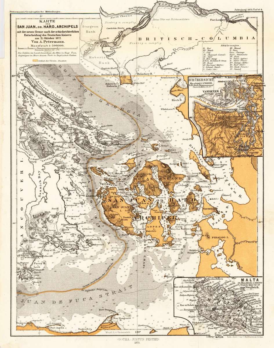
Petermann, A. – the San-Juan or Haro-Archipel · Lithograph, Printed in Colours · Petermanns Geographische Mitteilungen, Gotha · 1873
Eigenschaften
- Published: Justus Perthes. , Gotha
- Published date: 1873
- Type: Antique Map, map
- Technique: Lithograph / Original color.
- Issue date: 1873
- Category: Haro Strait - Vancouver Island
- Size: 253 by 191mm (10 by 7½ inches).
- Stock number: 26561
- Condition: In excellent condition. The map was originally published folded, so that the old folds are still slightly visible. 253 by 191mm (10 by 7½ inches).
Article description
Article description
Original antique lithograph, printed in colours, published by Justus Perthes in Gotha for 'Petermanns Geographische Mitteilungen', 1873. Lithograph, original color as published. Sheet: 253 by 191mm (10 by 7½ inches).. August Heinrich Petermann (1822–1878) was one of the most important German cartographers and geographers of the 19th century. Born in Bleicherode, Saxony, he trained at the Geographische Kunstschule in Potsdam under Heinrich Berghaus — himself a leading student of Alexander von Humboldt. After a formative decade in Edinburgh and London (1845–1854), where he gained broad experience in the commercial and scientific aspects of cartography, Petermann returned to Gotha and joined the Justus Perthes publishing house. In 1855 he founded 'Petermanns Geographische Mitteilungen' (PGM), which swiftly became one of the world's foremost geographical journals — the definitive record of the great age of exploration and discovery. Petermann personally produced over 500 maps and signed 226 articles in PGM, ranging across Africa, the Polar regions, Asia, and the history and practice of cartography. In 1902, the eminent British cartographer J. G. Bartholomew wrote: 'No one has done more than he to advance modern cartography.' His maps are held in major institutions worldwide, including the Library of Congress, the British Library, and the Bibliothèque nationale de France. Detailed map of the San-Juan or Haro-Archipel. The de Haro-Strait divides San-Juan Island from Vancouver Island. Nice and detailed interesting antique map for the collector of the Northwest. In excellent condition. The map was originally published folded, so that the old folds are still slightly visible.Petermann, A. – the San-Juan or Haro-Archipel · Lithograph, Printed in Colours · Petermanns Geographische Mitteilungen, Gotha · 1873
You might also be interested in the following products
 Pascaarte vande...
 Copper Engraving, uncolored by van Keulen, Joan, published 1684-1704 by Johannes van Keulen, Amsterdam. Image size:...
€1,100.00
 Britisches Nord -...
 Lithograph, original color in outline by Flemming, Carl, published 1845 - 50 by C. Flemming, Glogau. Image size: 310...
€84.00
 Johnson's...
 Lithograph, original color in outline by Johnson & Ward, published 1865 by Johnson & Ward, New York. Image...
€45.00
 Karte von den...
 Copper Engraving, uncolored by Bellin, Nicolaus, published 1753 by Merkur, Leipzig. Image size: 205 by 267mm (8 by 10...
€84.00
Recently viewed products