Johnson & Ward
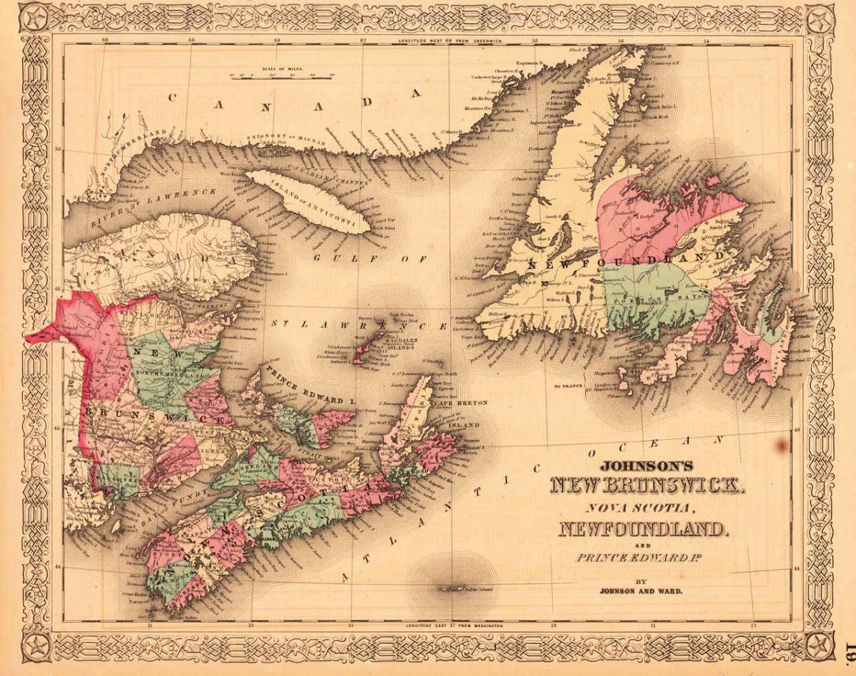
Johnson's New Brunswick, Nova Scotia, Newfoundland and Prince Edward P. by Johnson and Ward.
Johnson & Ward – Johnson's New Brunswick, Nova Scotia, Newfoundland and... · Antique Map, Lithograph · 320 x 400mm · Johnson & Ward, New York 1865
Eigenschaften
- Published: Johnson & Ward , New York
- Published date: 1865
- Type: Antique Map, map
- Issue date: 1865
- Technique: Lithograph / Original color
- Category: New Brunswick and New Foundland
- Size: 320 by 400mm (12 by 15 inches).
- Stock number: 28483
- Condition: On the sheet the upper margin is a bit narrow and a brown spot is visible else in very good condition. 320 by 400mm (12 by 15 inches).
Article description
Article description
Lithograph, original color in outline by Johnson & Ward, published 1865 by Johnson & Ward, New York. Image size: 320 by 400mm (12 by 15 inches). From Johnson's New Illustrated Family Atlas — the leading American atlas of the Civil War era. A.J. Johnson (Alvin Jewett Johnson, 1827–1884) was a New York publisher who created one of the most popular American atlas series of the mid-19th century. Having acquired the plates from Joseph H. Colton in 1860, Johnson produced Johnson's New Illustrated Family Atlas in many editions, partnering first with Browning and then with Benjamin P. Ward (Johnson & Ward, 1863–1866). The Family Atlas went through numerous editions during and after the Civil War, incorporating the latest geographic, railroad, and statistical information. Johnson's maps were engraved on steel with the finest detail available and are distinguished by their vivid hand-applied outline coloring. They are today among the most recognizable and collectible American antique maps of the 19th century. This beautiful decorative antique map shows the Island Newfoundland, Nova Scotia, Islands of Anticosti and New Brunswick. On the sheet the upper margin is a bit narrow and a brown spot is visible else in very good condition.Johnson & Ward – Johnson's New Brunswick, Nova Scotia, Newfoundland and... · Antique Map, Lithograph · 320 x 400mm · Johnson & Ward, New York 1865
You might also be interested in the following products
 Pascaarte vande...
 Copper Engraving, uncolored by van Keulen, Joan, published 1684-1704 by Johannes van Keulen, Amsterdam. Image size:...
€1,100.00
 Britisches Nord -...
 Lithograph, original color in outline by Flemming, Carl, published 1845 - 50 by C. Flemming, Glogau. Image size: 310...
€84.00
 Johnson's...
 Lithograph, original color in outline by Johnson & Ward, published 1865 by Johnson & Ward, New York. Image...
€45.00
 Karte von den...
 Copper Engraving, uncolored by Bellin, Nicolaus, published 1753 by Merkur, Leipzig. Image size: 205 by 267mm (8 by 10...
€84.00
Recently viewed products