Tallis, J & F.
Nova Scotia and Newfoundland
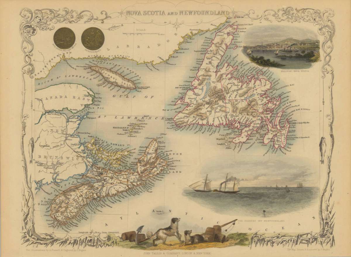
Tallis, J & F. – Nova Scotia and Newfoundland · Antique Map, Steel Engraving · 260 x 330mm · John Tallis and Company, London & New York 1851
Eigenschaften
- Published: London & New York
- Published date: 1851
- Type: Antique Map, map
- Issue date: 1851
- Technique: Steel engraving, hand colored.
- Category: Nova Scotia, New Foundland
- Size: 260 by 330mm (10 by 13 inches).
- Stock number: 29615
- Condition: In excellent condition.
Article description
Article description
Steel Engraving, hand-colored in outline by Tallis, J & F, published 1851 by John Tallis and Company, London & New York. Image size: 260 by 330mm (10 by 13 inches). From Tallis's celebrated Victorian World Atlas — among the most decorative and sought-after maps of the 19th century. John & Frederick Tallis were a celebrated London publishing house active in the mid-19th century, known for producing some of the most beautiful decorative atlases of the Victorian era. Their World Atlas (c.1850–1851) is distinguished by its elaborately illustrated borders featuring vignettes of native peoples, flora, fauna, and architectural monuments of each depicted region — engraved by John Rapkin and among the finest examples of Victorian decorative cartography. Though produced at a time when scientific accuracy had largely supplanted decoration in cartography, Tallis deliberately maintained an ornamental tradition that has made these maps enduringly popular with collectors seeking both aesthetic beauty and historical content. This beautiful decorative antique map shows the Island Newfoundland, Nova Scotia, Anticosti Island and New Brunswick. In the upper left corner are two gold coins, one from Nova Scotia and the other from Newfoundland. In the upper right corner is a very nice engraving from Halifax in Nova Scotia. Under the Island Newfoundland is an Ocean scene with few ships. Surrounded from an decorative border are two dogs and some wine barrels engraved. The map is drawn and engraved by J. Rapkin and the illustrations are engraved by J. Rogers. In excellent condition.Tallis, J & F. – Nova Scotia and Newfoundland · Antique Map, Steel Engraving · 260 x 330mm · John Tallis and Company, London & New York 1851
You might also be interested in the following products
 Pascaarte vande...
 Copper Engraving, uncolored by van Keulen, Joan, published 1684-1704 by Johannes van Keulen, Amsterdam. Image size:...
€1,100.00
 Britisches Nord -...
 Lithograph, original color in outline by Flemming, Carl, published 1845 - 50 by C. Flemming, Glogau. Image size: 310...
€84.00
 Johnson's...
 Lithograph, original color in outline by Johnson & Ward, published 1865 by Johnson & Ward, New York. Image...
€45.00
 Karte von den...
 Copper Engraving, uncolored by Bellin, Nicolaus, published 1753 by Merkur, Leipzig. Image size: 205 by 267mm (8 by 10...
€84.00
Recently viewed products