Meyer, Joseph & Radefeld, Hauptmann von
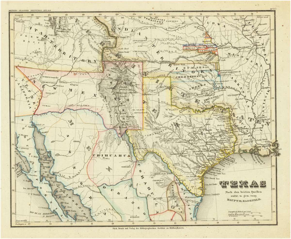
Texas Nach den besten Quellen entw. u. gez. vom Hauptm. Radefeld.
Prices incl. VAT plus shipping costs
This item is sold. Please contact us if you are searching for this item.
- Published: Hildburghausen
- Published date: 1850
- Type: Antique Map, map
- Technique: Steel engraving, original color
- Category: Texas
- Issue date: 1850-53
- Size: 290 by 360mm (11½ by 14¼ inches).
- Stock number: 31510
- Condition: In excellent condition.
Article description
Steel engraving, hand colored in outline when published. A highly detailed map of Texas, compiled and drawn by Captain Radefeld, published by Joseph Meyer in his famous edition of the large,Zeitungsatlas' around 1850-53 in Hildburghausen. Map shows the western boundary of Texas encompassing Santa Fe, the eastern boundary encompassing area of Louisiana along the Red River and into the Mississippi River delta.Texas is shown very detailed on this map with engraved place names, streets, routes, rivers, mountains and even a silver mine, salt lakes and Indian tribes are shown on the map. The outline hand color is from the period as published. Information on the various Indian tribes is given on the map as well. Texas extends in the north towards the neighboring Wyoming with the Missouri territory, in the west to New Mexico and the Utah territory. This map was published in the so-called,Zeitungsatlas', which is famous because of the great details of the various US maps, which were included in this atlas. Most of these maps were based on the cartographic information by Tanner and were updated with German geographic sources.
You might also be interested in the following products
 Neueste Karte von...
  Views from Mt....
  Gray's New...
  Amér. Sep. Ile De...