Ortelius, Abraham
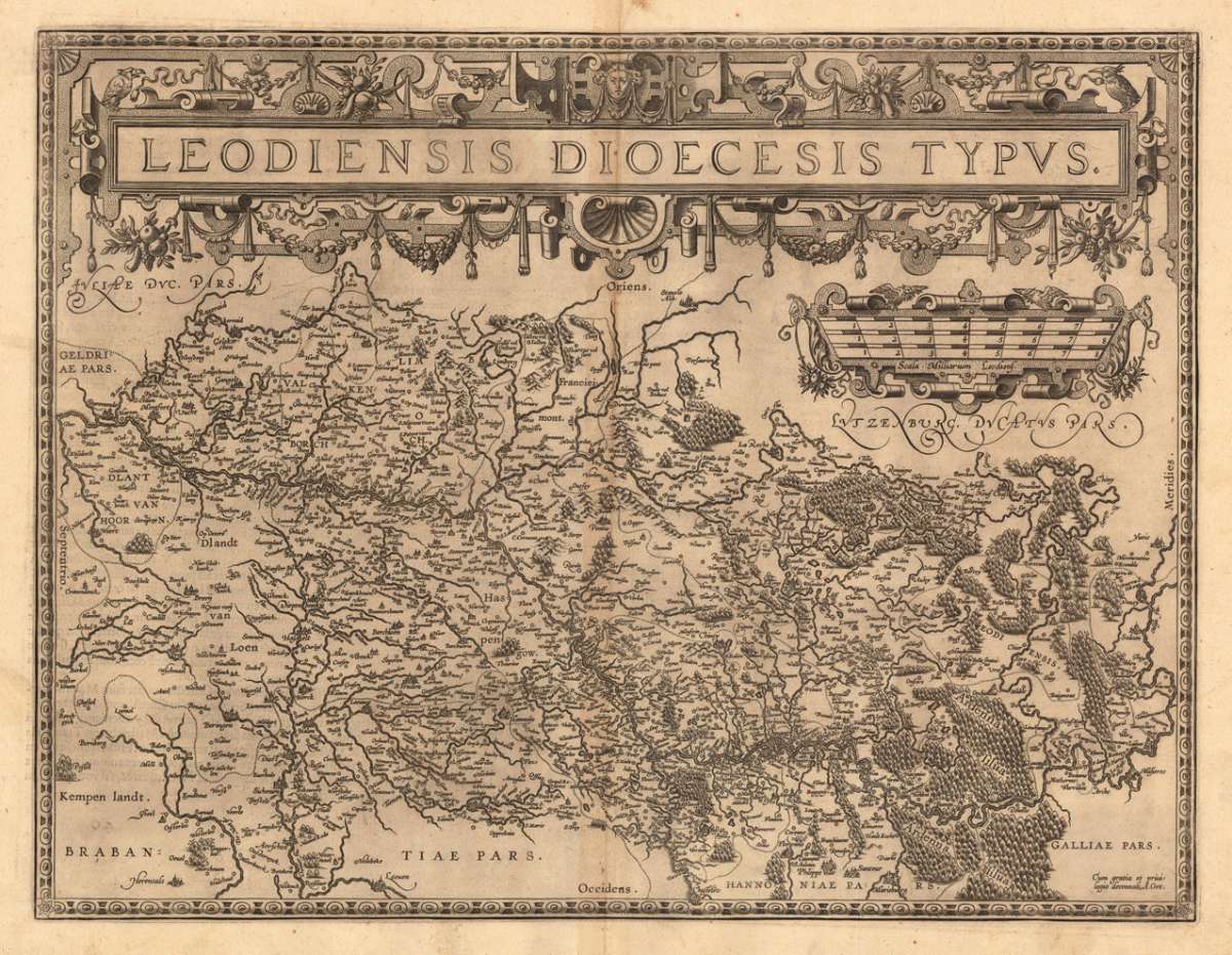
Leodiensis Dioecesis Typus.
Eigenschaften
- Published: Antwerp
- Published date: 1598
- Type: Antique Map, map
- Technique: Copper engraving / Uncolored
- Issue date: 1598
- Category: Luttich (Liege)
- Size: 380 by 497mm (15 by 19 inches).
- Bibliography: Broe. 64. State 1/3.
- Stock number: 13893
- Condition: In excellent condition.
Article description
Article description
Original antique copper engraving, published 1598 in a French text edition of the 'Theatrum Orbis Terrarum'. Uncolored copy in a strong impression. The map is ornated a large title cartouche and below a decorative milage scale. This antique map shows Luttich in Belgium. The map is equipped with many small place names, rivers, woods, etc. Ortelius was born on 14 April 1527 in the city of Antwerp, which was then in the Habsburg Netherlands (modern-day Belgium). The Orthellius family were originally from Augsburg, a Free imperial city of the Holy Roman Empire. In 1535, the family had fallen under suspicion of Protestantism. Following the death of Ortelius's father, his uncle Jacobus van Meteren returned from religious exile in England to take care of Ortelius. Abraham remained close to his cousin Emanuel van Meteren, who would later move to London. In 1575 he was appointed geographer to the king of Spain, Philip II, on the recommendation of Arias Montanus, who vouched for his orthodoxy. He travelled extensively in Europe and is specifically known to have traveled throughout the Seventeen Provinces; in southern, western, northern, and eastern Germany (e.g., 1560, 1575–1576); France (1559–1560); England and Ireland (1576); and Italy (1578, and perhaps twice or thrice between 1550 and 1558). Beginning as a map-engraver, in 1547 he entered the Antwerp Guild of Saint Luke as an illuminator of maps. He supplemented his income trading in books, prints, and maps, and his journeys included yearly visits to the Frankfurt book and print fair, where he met Gerardus Mercator in 1554. In 1560, however, when travelling with Mercator to Trier, Lorraine, and Poitiers, he seems to have been attracted, largely by Mercator's influence, towards the career of a scientific geographer. (Wikipedia)Broe. 64. State 1/3.
You might also be interested in the following products
 Nobilis Hannoniae...
 Original copper engraving, published 1588 in the first Spanish text edition of the 'Theatrum Orbis...
€295.00
 Accurata...
 Copper-engraving, handcolored in outline and wash when published. With many engraved place names of smaller cities...
€190.00
 Brabantiae...
 Copper-engraving, handcolored in wsh and outline when published. Detailed map of the duchy of Brabant with the...
€260.00
 Nobilis Hannoniae...
 Original antique copper engraving, published 1598 in a French text edition of the 'Theatrum Orbis...
€295.00
Recently viewed products