Europe
No results were found for the filter!
 Lumen Historiarum Per Occidentem ex conatibus Fran. Hareio Antuerpiae; P. Kaerius Caelavit.
 Original antique copper engraving, decorative handcolored in outline when published. Published in a Latin text...
€495.00
 Europam; sive Celiticam Veterem. Sic describere conabar Abrahamus Ortelius Evert Sijmons z. Hamers veldt sculpsit.
 Original antique copper engraving, decorative handcolored in outline when published. Published in a Latin text...
€595.00
 Imperium Romanum Auth. Phil. Briet e societ. Iesu.
 Original antique copper engraving, decorative hand colored in outline. A highly decorative map, which is ornated with...
€595.00
 Le nord de l'Europe contenant le Danemark, la Norvège, la Suède et la Laponie, avec la majeure partie de la...
 Original antique copper engraving, hand colored in outline and wash. Decorative double page map from 'Atlas de...
€85.00
 Nova Totius Europae Tabula
 Original copper engraving, hand colored in outline and wash when published. Published circa 1710. Outstanding large...
€30,000.00
 L´Empire D´Allemagne dedié a Monseigneur Amelot Ministre et Secretaire D´Etat a Paris Chez Crepy 1767.
 Original Kupferstich in zeitgenössischem Grenzkolorit. Dargestellt wird das Deutsche Reich mit seinen Staaten,...
€120.00
 Charte von Europa neu entworfen von F.L. Güssefeld. Nürnberg zu finden bey C. Weigel u. Schneider 1794.
 Copper engraving, hand colored in outline and wash when published. The map depicts Europe with its neighbouring...
€375.00
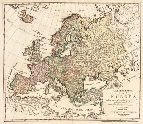
 Generalkarte von Europa, nach den neuesten astronomischen Beobachtungen, den vorzüglichsten Special-Karten und zu...
 Original antique copper engraving, hand colored in outline and wash when published. An interesting and detailed map...
€445.00
 Geographia Synodica, Sive regionum urbium, et locorum ubi celebrata sunt concilia oecumenica, nationalia,...
 Copper engraving, hand colored in outline when published. A decorative historical map of Europe in original outline...
€345.00
 Romania Imperii Ova Oriens Est Descriptio Geographica Authore Michaelè Antonio Baudrand Parisino Abbate de Roboribus...
 Copper engraving, uncolored as published.
€295.00
 Karte der wichtigsten Habituellen Stossgebiete in Central-Europa. Nach Dr. Volger's Untersuchungen gez. von A....
 Lithograph, original color in outline as published.
€25.00
 Europa
 Copper engraving, hand colored in outline. Interesting map of Europe probably published by T. Mollo in Vienna....
€110.00
Recently viewed products

