Janssonius, Joan.
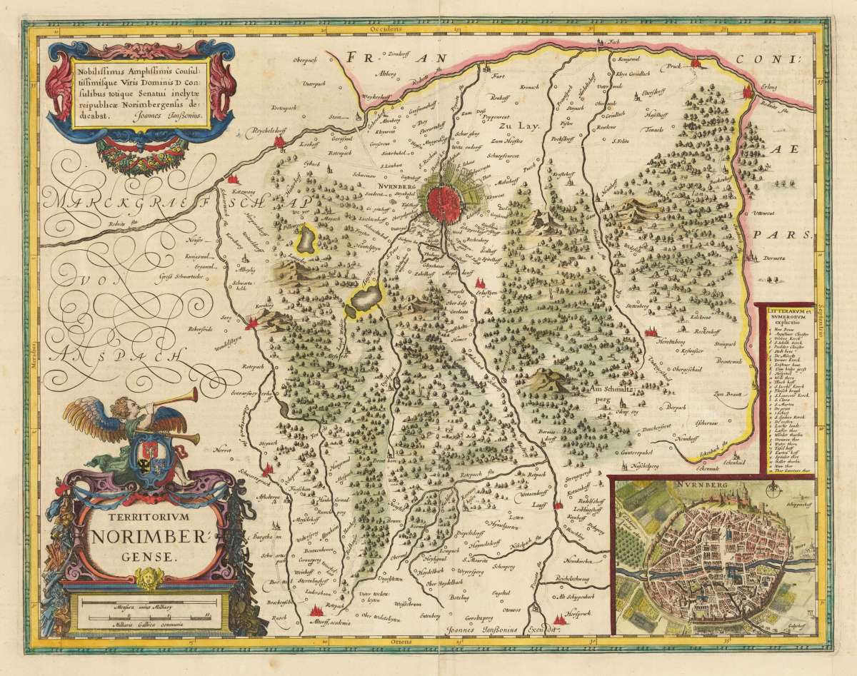
Nürnberg
Nürnberg - Joan. Janssonius ∑ Hand-Colored Original Copperplate Engraving ∑ Amsterdam 1642
Eigenschaften
- Published: Amsterdam
- Published date: 1642
- Issue date: 1642
- Category: Franken
- Type: map
- Technique: Copper engraving / hand colored.
- Size: 363 by 463mm (14 by 18 inches).
- Bibliography: Koe. Me. 100A, 95
- Stock number: 29120
- Condition: Schönes Exemplar in zeitgenöss. Kolorit und gutem Erhaltungszustand.
Article description
Article description
Hand-Colored Original Copperplate Engraving by Joan. Janssonius, depicting Nürnberg. Published Amsterdam, 1642. Sheet: 363 by 463mm (14 by 18 inches).. A fine and original hand-colored example of Janssonius's celebrated cartographic work, documenting this region of Germany with the precision and decorative artistry characteristic of the 16400s. Johannes Janssonius (1588-1664) was one of the foremost Dutch cartographers and publishers of the 17th century, based in Amsterdam. A son-in-law of Jodocus Hondius, he continued the great Mercator-Hondius atlas tradition and was a fierce rival of Joan Blaeu. His multi-volume atlases -- published under the Mercator/Hondius/Janssonius imprint -- were standard reference works of the age, known for accurate engraving and fine hand coloring. Janssonius maps represent the very best of the Dutch Golden Age of cartography and are held in major collections worldwide. This original copperplate engraving, with original hand coloring depicts the region of Nürnberg, published in Amsterdam, 1642. The map features a decorative Baroque cartouche containing the title inscription. The map records the political and geographic boundaries of the region as understood in 1642, offering a fascinating window into the history of German territorial organization. Sheet measures 363 by 463mm (14 by 18 inches).. In good condition overall, with minor signs of age appropriate for a 17th-century engraving. Ready to frame.Nürnberg - Joan. Janssonius ∑ Hand-Colored Original Copperplate Engraving ∑ Amsterdam 1642
Koe. Me. 100A, 95
You might also be interested in the following products
 Circulus...
 Hand-Colored Original Copperplate Engraving by Christoph Weigel, depicting Circulus Franconicus ad Occidentem vergens...
€195.00
 Die Ludwigsbrücke...
 Hand-Colored Original Steel Engraving by Ludwig Lange, depicting Die Ludwigsbrücke in Bamberg.. Published München, G....
€40.00
 Der Dom zu Bamberg.
 Hand-Colored Original Steel Engraving by Ludwig Lange, depicting Der Dom zu Bamberg.. Published München, G. G. Lange,...
€75.00
 Schleusse am...
 Hand-Colored Original Steel Engraving by A. Marx, depicting Schleusse am Malckerspund in Bamberg.. Published...
€110.00
Recently viewed products