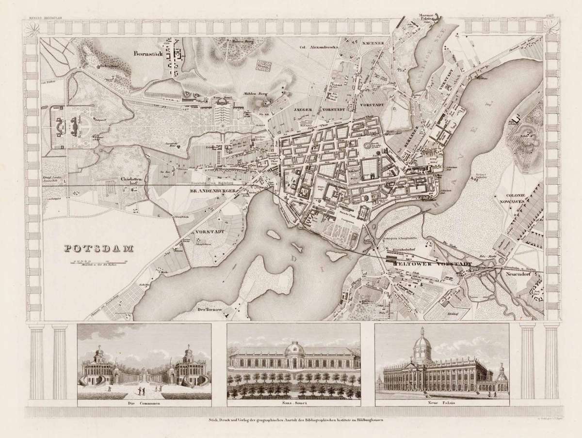
Eigenschaften
- Published: Hildburghausen
- Published date: 1847
- Technique: Steel engraving uncolored
- Type: map
- Issue date: 1847
- Category: Potsdam
- Size: 255 by 345mm (10 by 13 inches).
- Stock number: 28151
- Condition: In excellent condition.
Article description
Article description
Original Steel Engraving by C. Radefeld, depicting Potsdam. Published Hildburghausen, Meyer, 1847. Sheet: 255 by 345mm (10 by 13 inches).. A fine and example of Radefeld's celebrated cartographic work, documenting this region of Germany with the precision and decorative artistry characteristic of the 18400s. C. Radefeld was a cartographer active in the 1800s, working in the tradition of European copper-engraved cartography. Their maps are valued by collectors for their historical accuracy and decorative quality. This original steel engraving depicts the region of Potsdam, published in Hildburghausen, Meyer, 1847. The map records the political and geographic boundaries of the region as understood in 1847, offering a fascinating window into the history of German territorial organization. Sheet measures 255 by 345mm (10 by 13 inches).. In good condition, showing expected signs of age. Ready to frame.Potsdam - C. Radefeld ∑ Original Steel Engraving ∑ Hildburghausen 1847
Recently viewed products